If Tuesday was our “Fire Day” (Volcanoes National Park”) and Wednesday was Water Day (Snorkeling the coral reefs), today was the perfect Hegelian synthesis of the two, as we got to see lava flowing into the ocean! That’s the short version! The “let’s remember what we did today” variation goes like this:
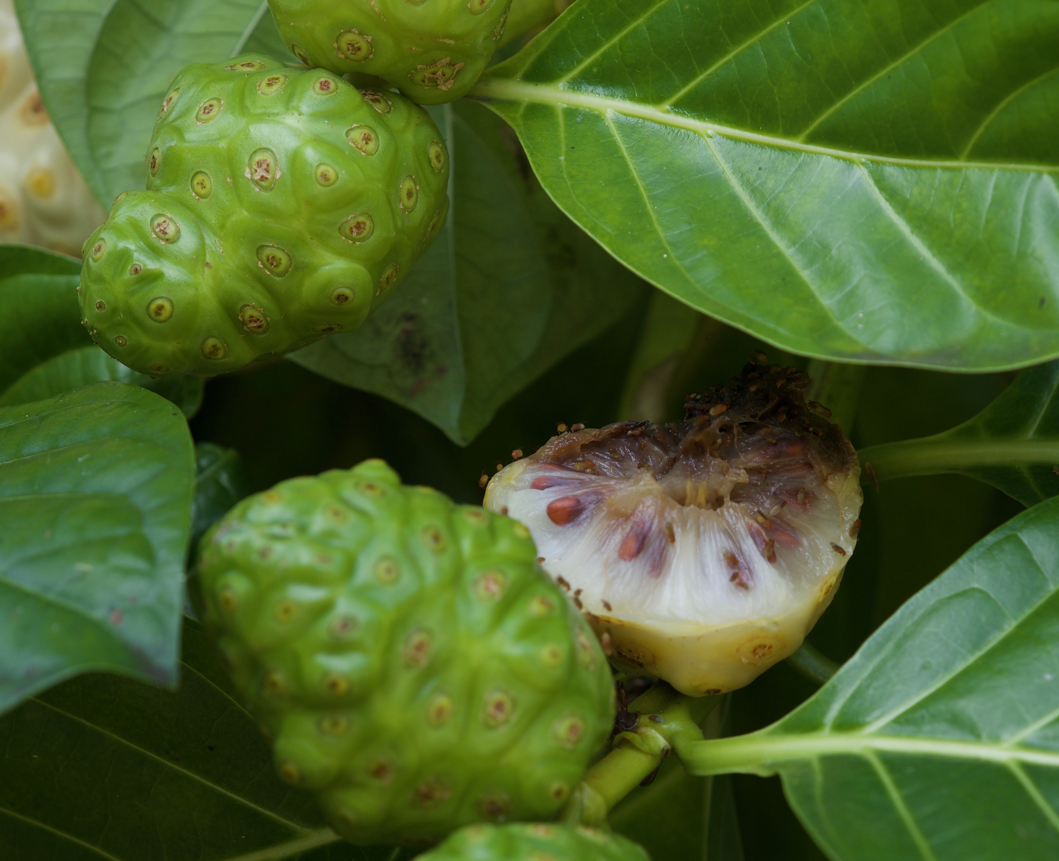
We got an early start, with a picnic lunch in two and the plan of going to South Point, the southern tip of the island, today–a plan we later ditched for now. We went down the same coastal highway as before, but stopped at a National Historical site that my friend Laurie, who lives on Kaua’i, had recommended–it is a recreation of former royal grounds of the kings and priests, and the place of refuge, or Pu’uhonua o Honanau, where people who had broken the law of the land could basically apply for asylum and purge themselves of their crime, and where children and old people could find shelter during war times. It was a nice little walk directly on the coast line, but despite the recreated huts and the long wall made of lava without mortar that marked off the place of refuge, it was still hard to envision the life of the ancient Hawaiians for me. But we did see some cool plants, including the weird-looking noni or Indian Mulberry.
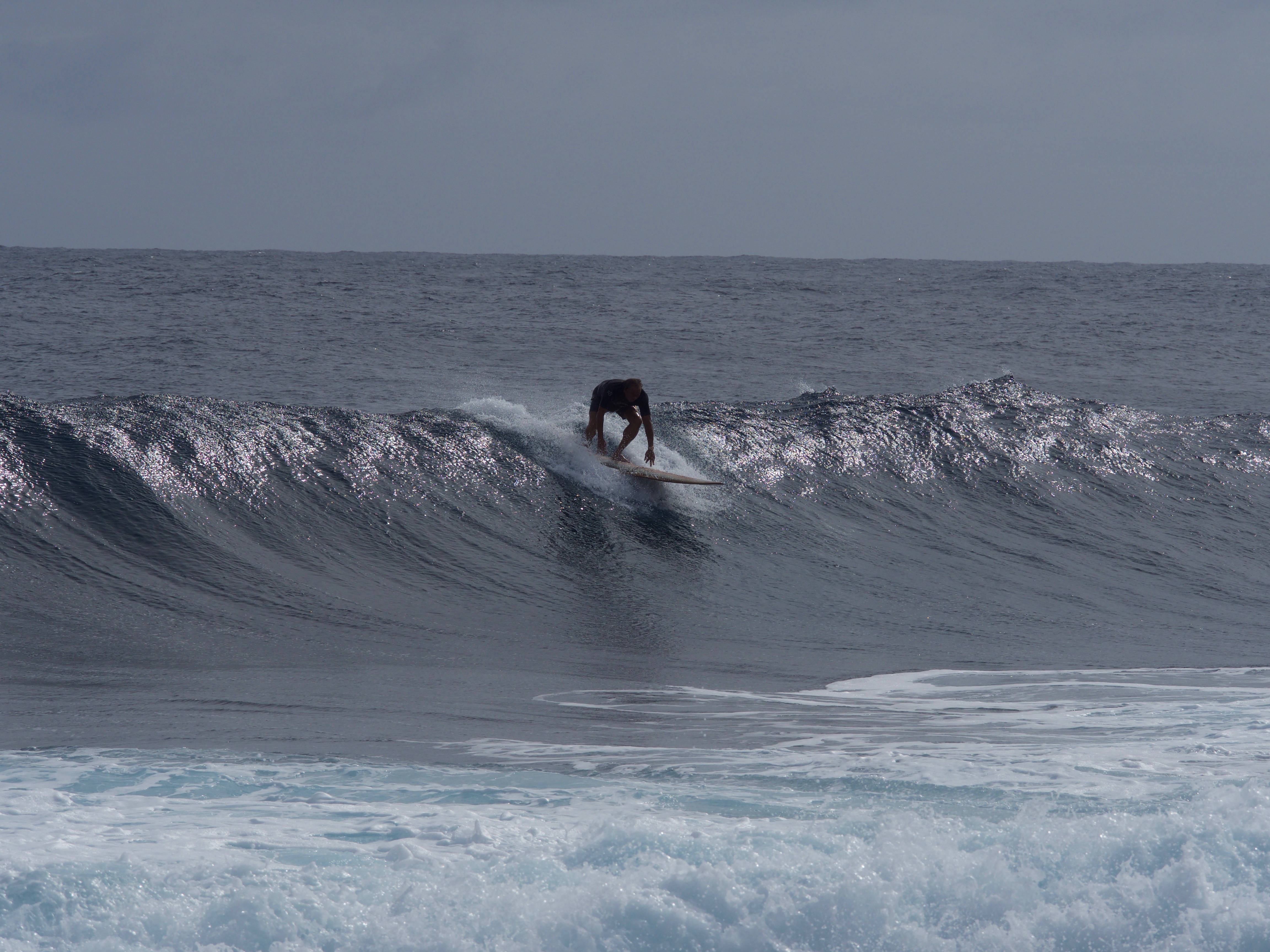
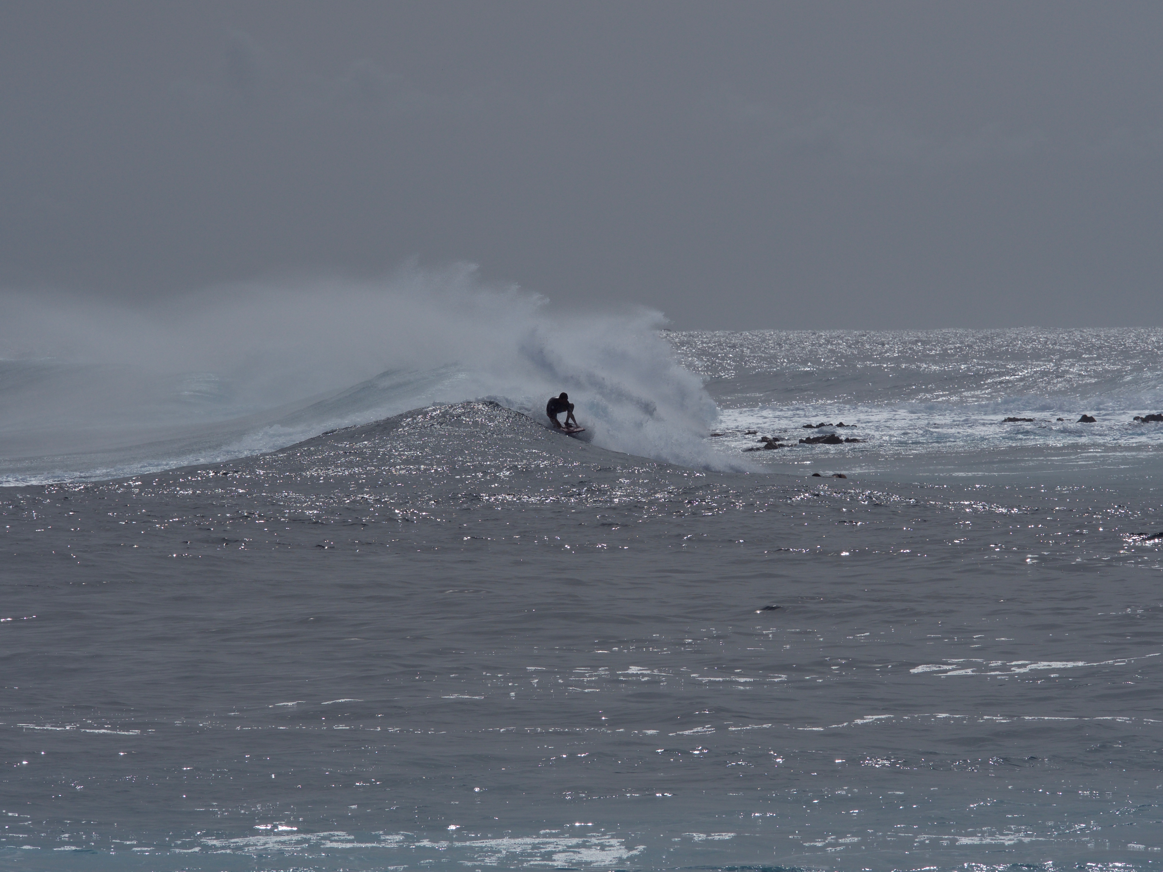
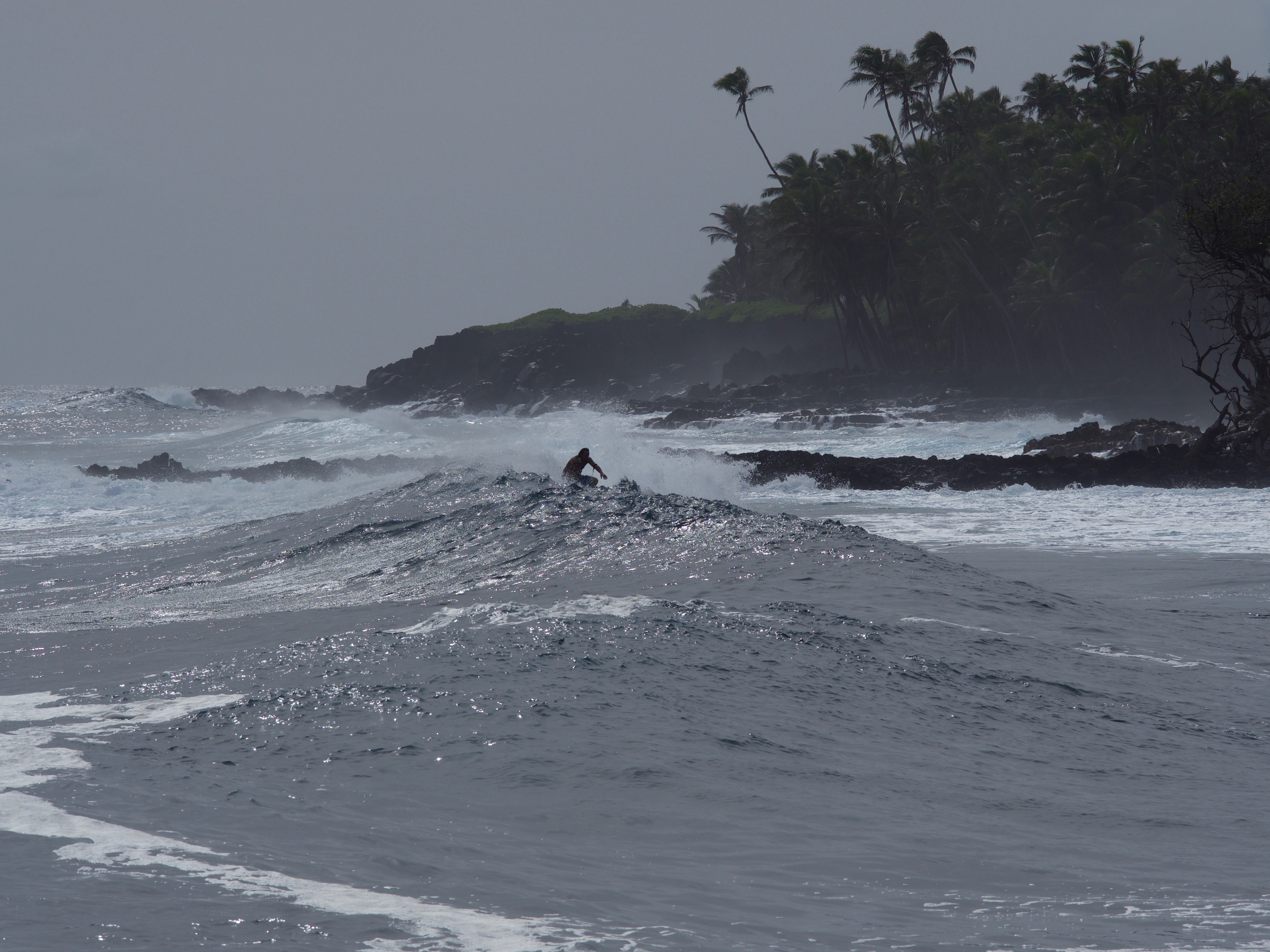
As we drove on, we decided on the spur of the moment (with the help of the always-accessible internet info) that this would be our day to drive the extra two hours from where we were to the access point for the easiest, shortest route to the current lava flow. So we drove past the national park, and to the southwestern corner of the island and found ourselves a lovely lunch in a small cafe in the town of Mountain View (I finally had a plate lunch, the famous “put something of everything on the plate” that is the classic Hawaiian diner meal–it was delicious and very fresh, including a coconut jello-style dessert and some nice carnitas-style pork, but also poi, a blob made out of a pounded, creamed root called kalo or taro for a starch that tasted like absolutely nothing in a really startling way–thickened water comes to mind as a descriptor). Then we took a little detour to see the coastline as far into the southeastern corner of the island as we could. It was a gorgeous, lush green rainforest with occasional “jungle tunnels” where the vegetation was over our heads as well as on the side of the road. We stopped at a couple of little recreation areas on the way, to watch the waves crash into the rocks (my current obsession) and we even got to watch surfers for a while at a little local beach access called Isaac Hale Beach.
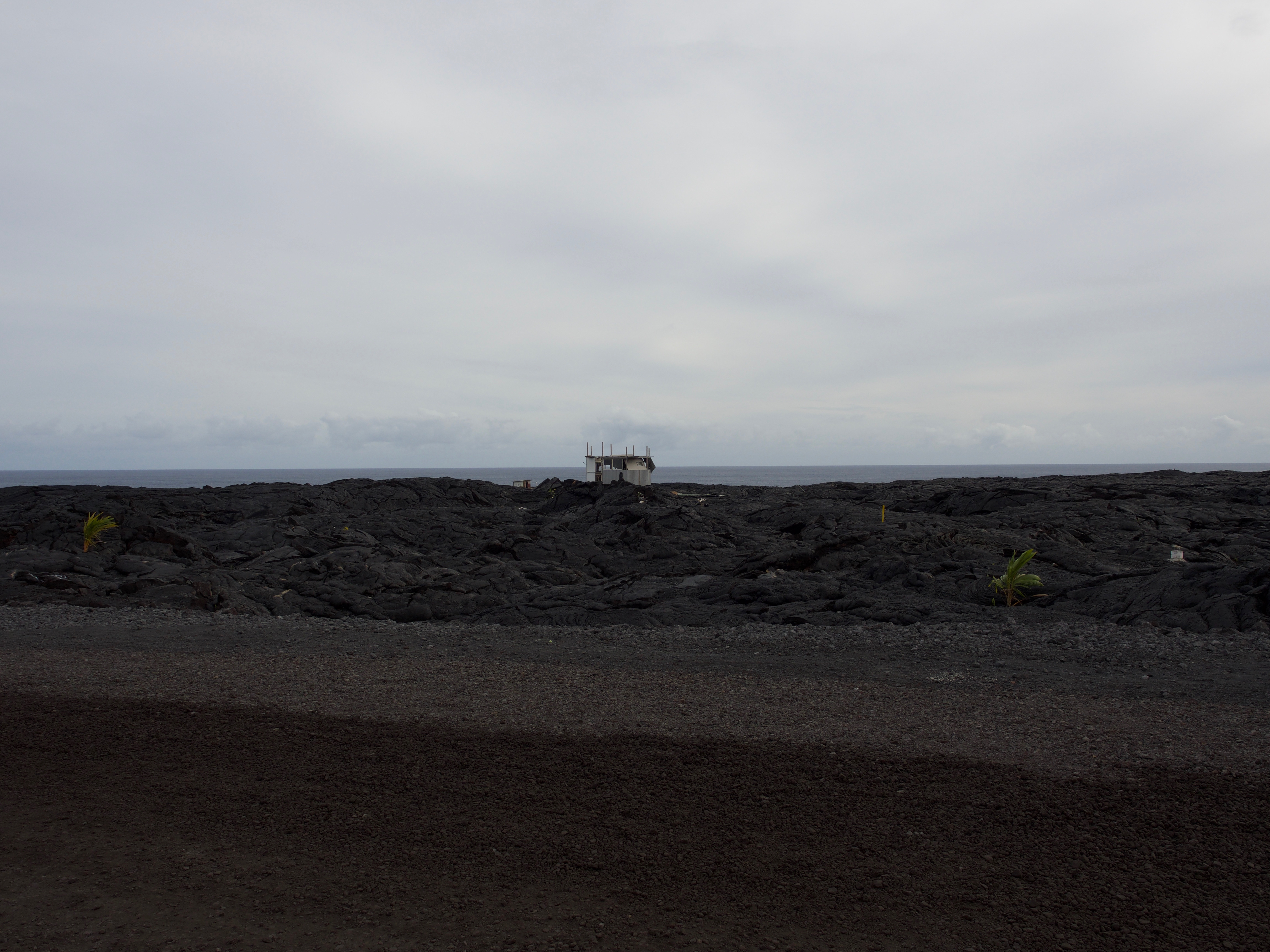
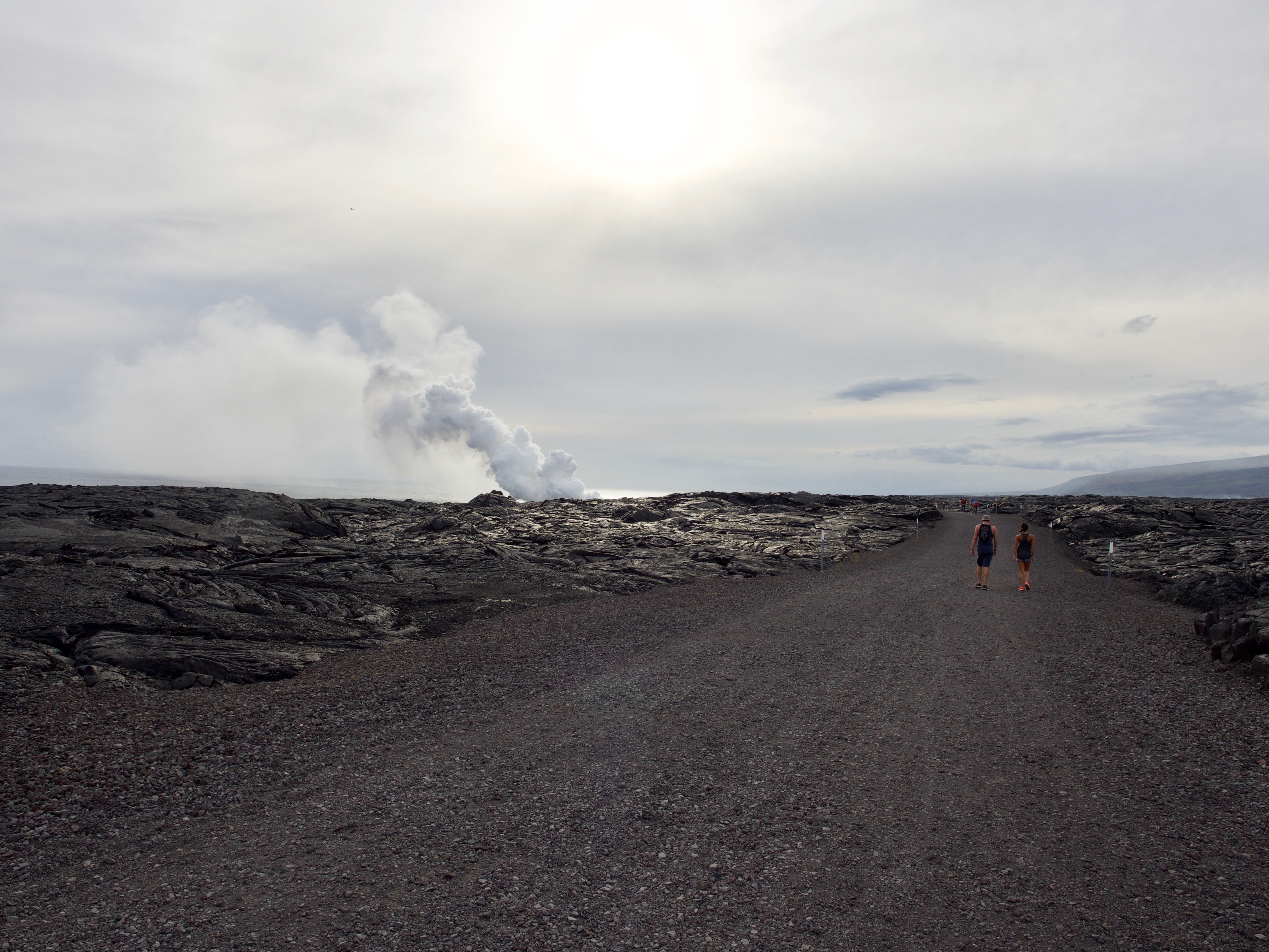
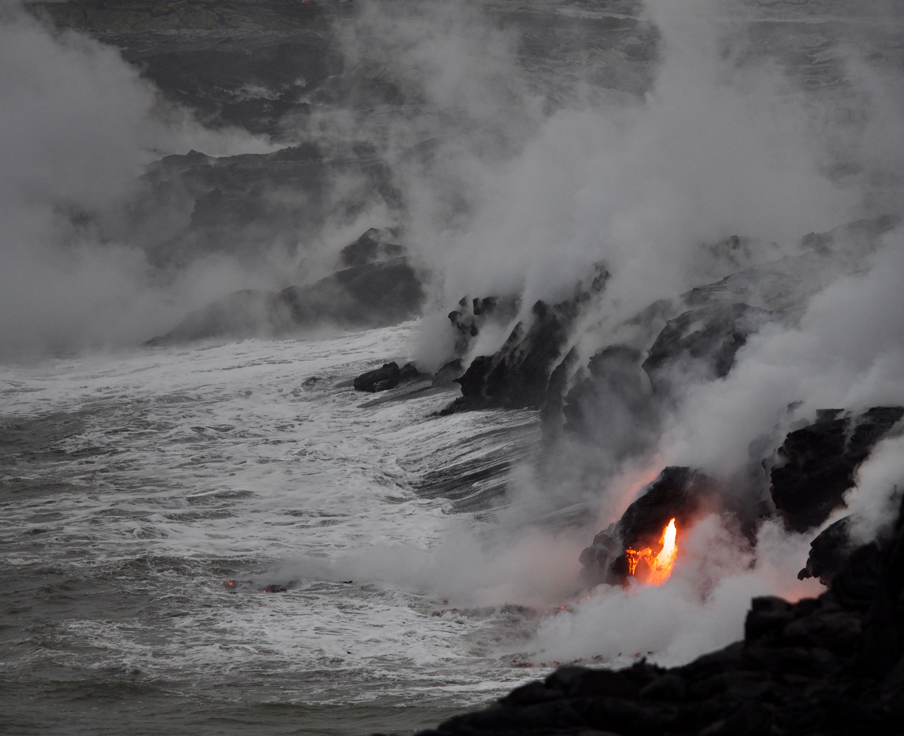
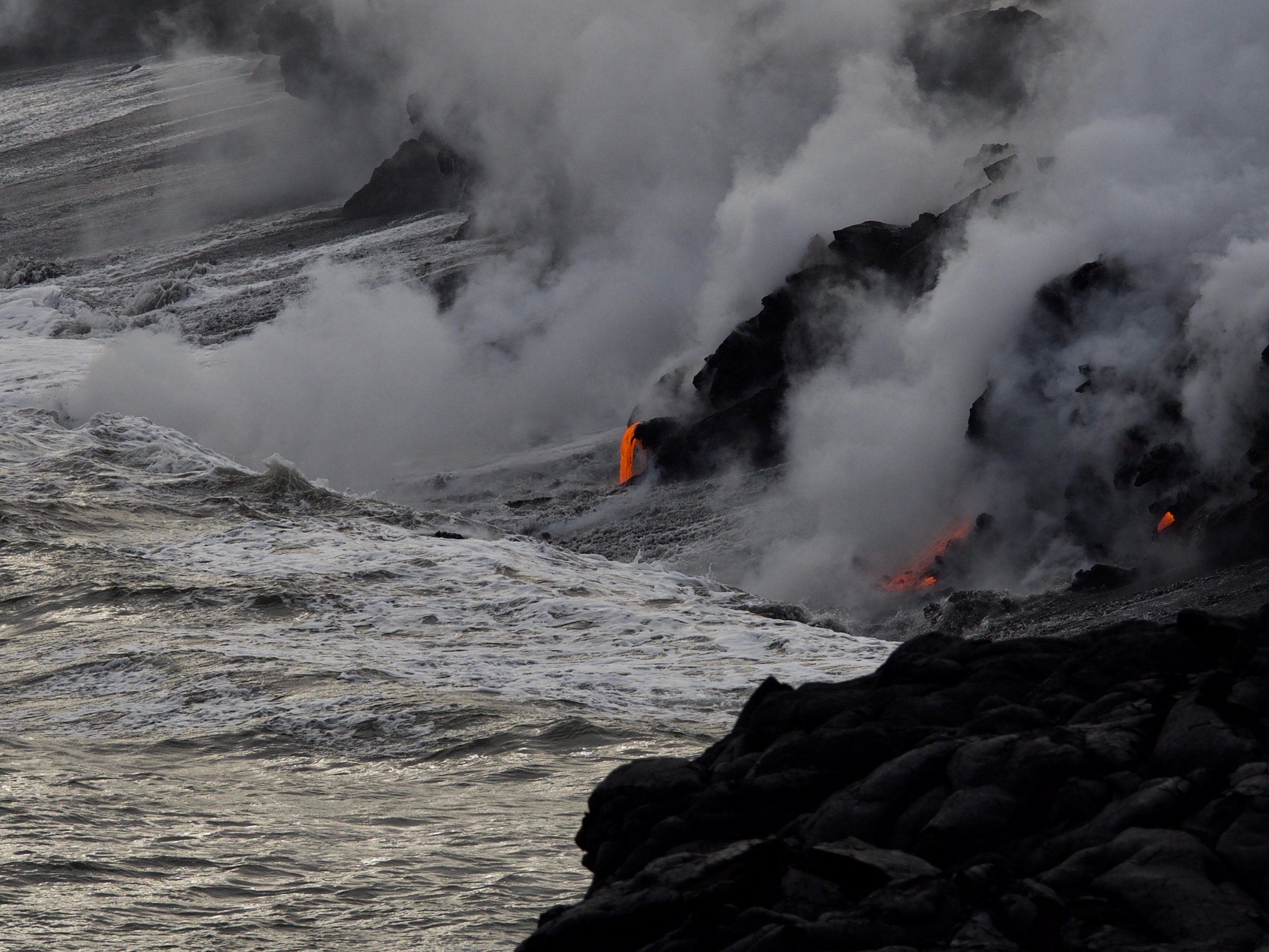
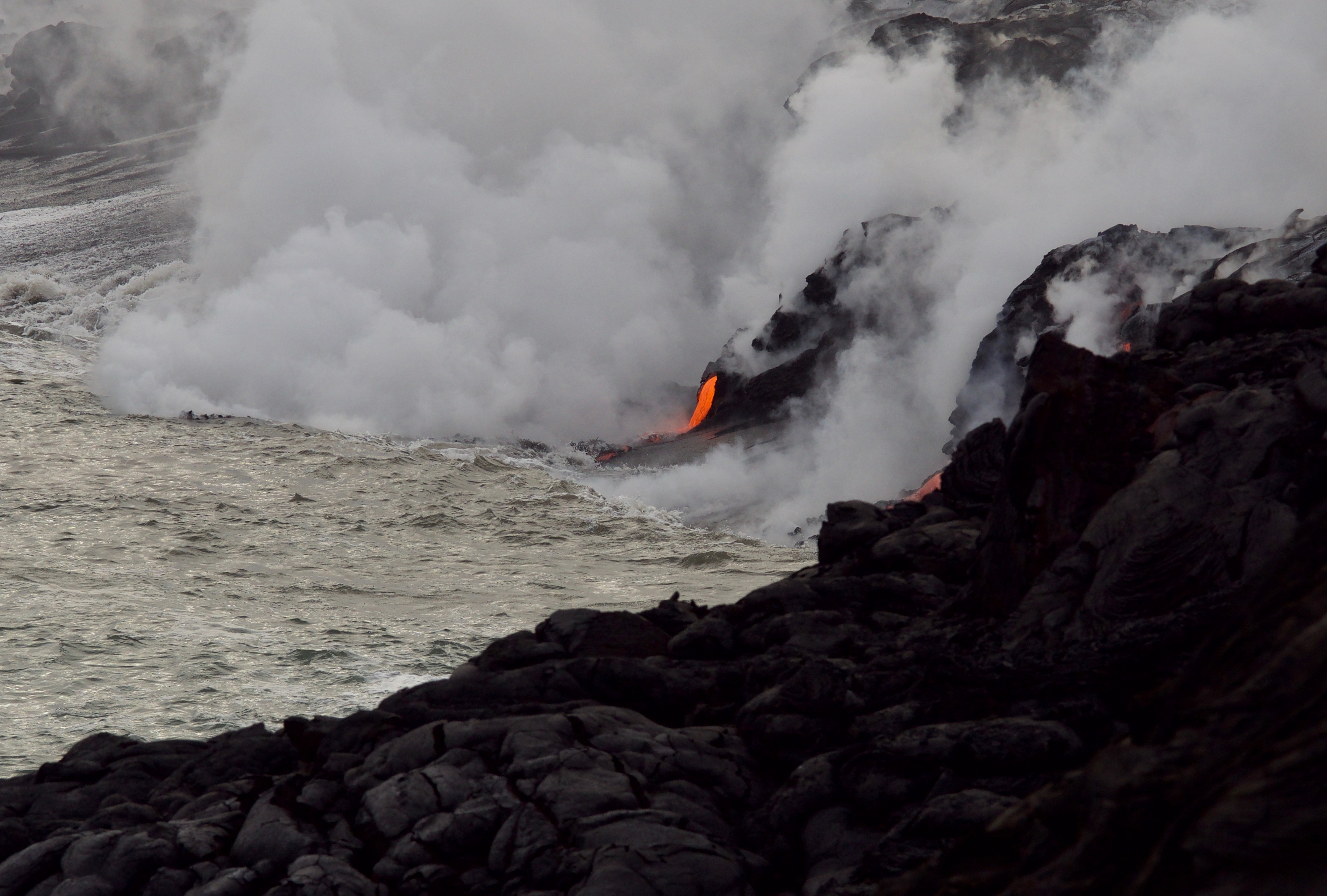
Then we made our way to the end of Highway 130, to Kalapana, where the county has provided east-side access to the national park are where the lava flow is. We tried to time it right for about 3 pm, when the area opens for hikers. As we were searching for the right parking lot, Mark ended up talking to a local, name of “Doc” who said he had a house on the way and would let us park a bit closer than the usual parking lot, if we wanted to shorten our hike by a mile each way. That sounded a bit sketchy to me (he was making $ 20 off of us that way), but I trusted Mark’s usual good luck with such things, and we ended up following him through the long, long parking lot with room for hundreds of vehicles and lots of impromptu food stands, knick knack tables, and bicycle rentals, as the lush vegetation abruptly stopped where the lava flow from 1983 began and we got the barren, alien landscape from the other day. We really did get about a mile further in, past the county’s guards, who just needed to hear that we were “with Doc” to let us go past the access gates. Doc’s “house,” along with five or so others in the same area, was a half-finished hut built on top of the lava flow. Apparently, this lava-covered area (which according to Doc looked just like the rainforest coastline we had seen further east) is now being re-surveyed, and people who had claim to a lost piece of land through Hawaiian ancestry get it back. So he built his here (although now 150 feet further inland than before the lava flow), right near the emergency access route that has now become the “lava flow route” that is taken by thousands of tourists a day, by bike and on foot, since the flow, charmingly named 61g, started just this past May, reaching the ocean in July.
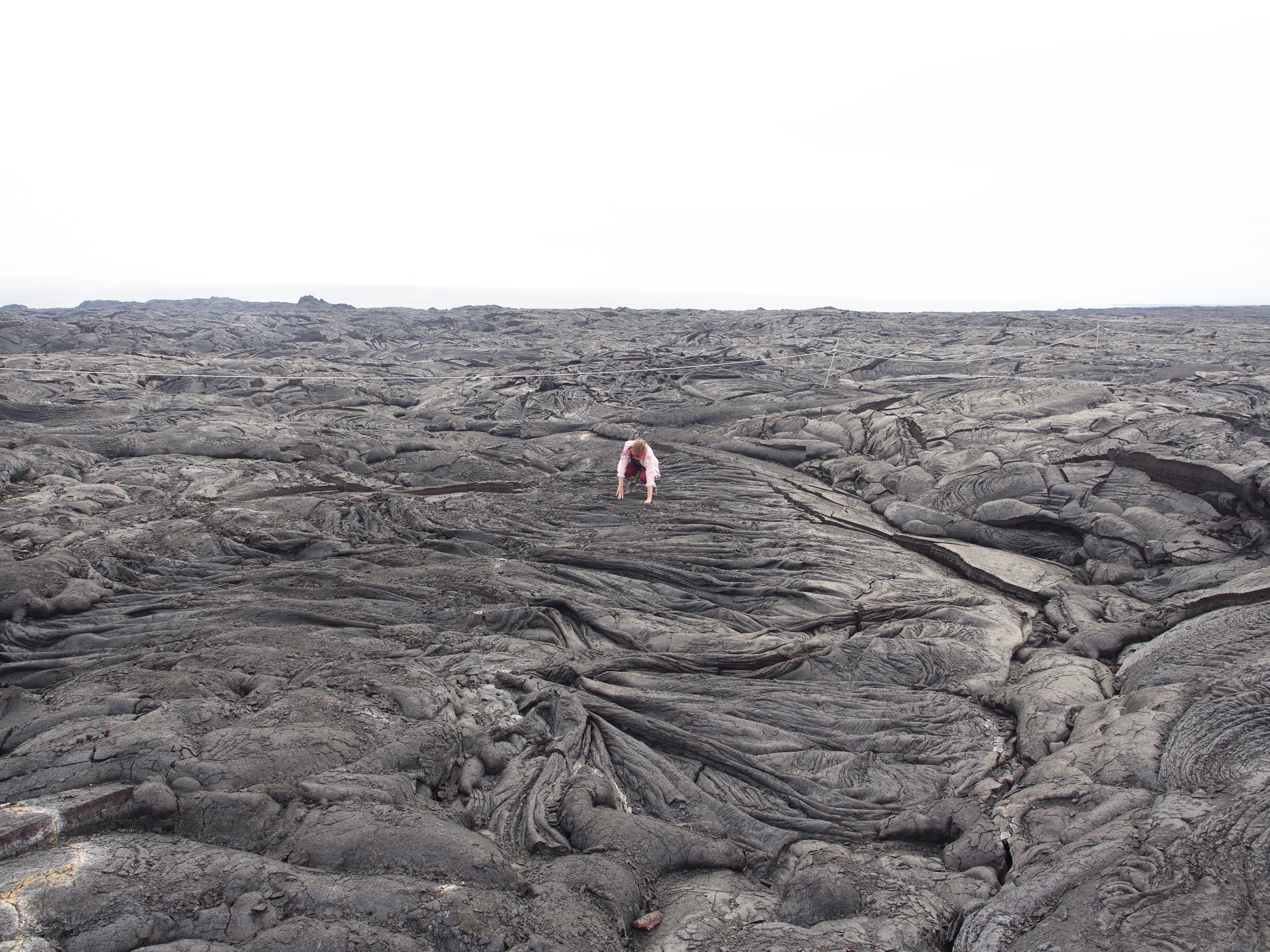
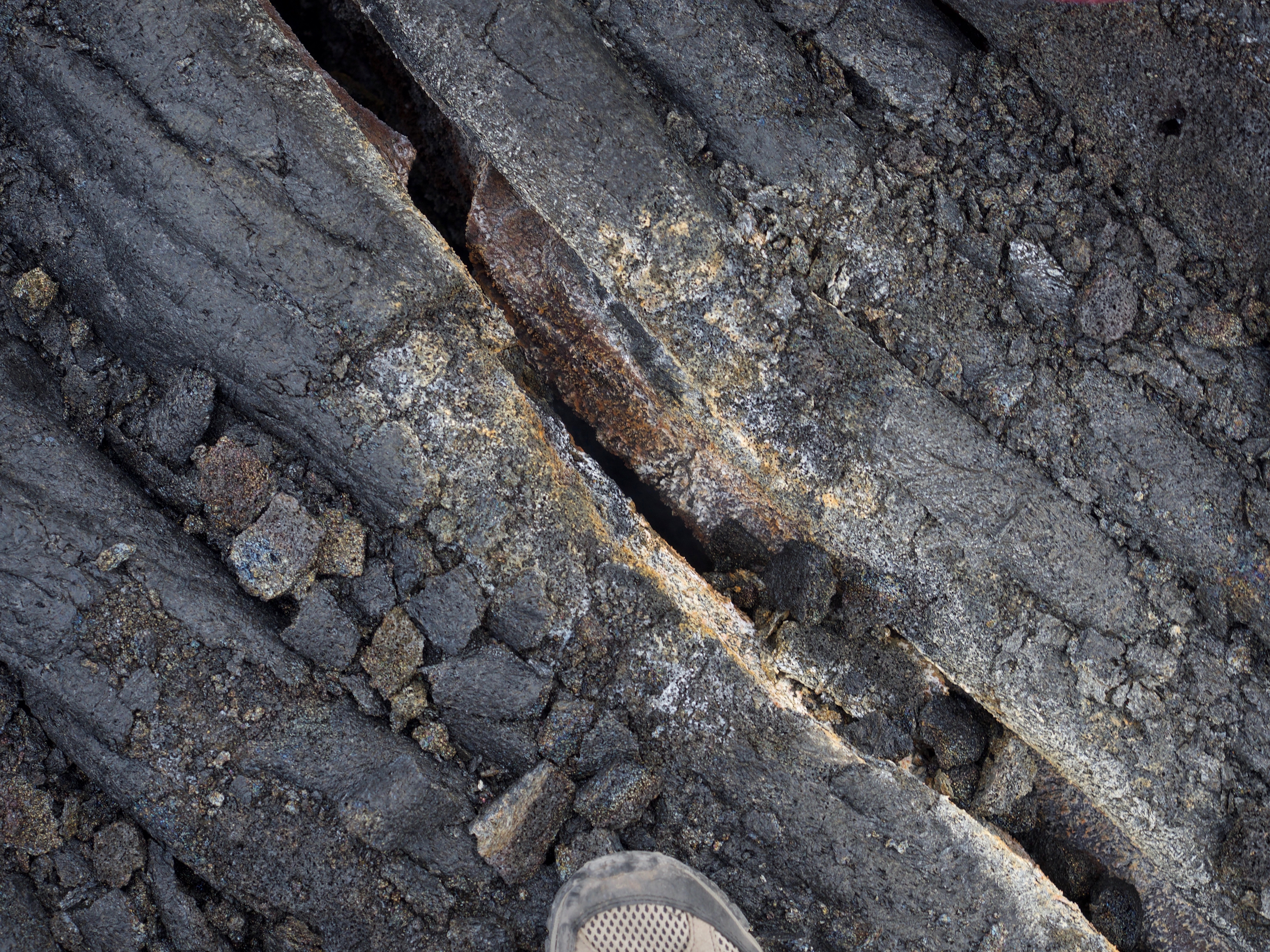
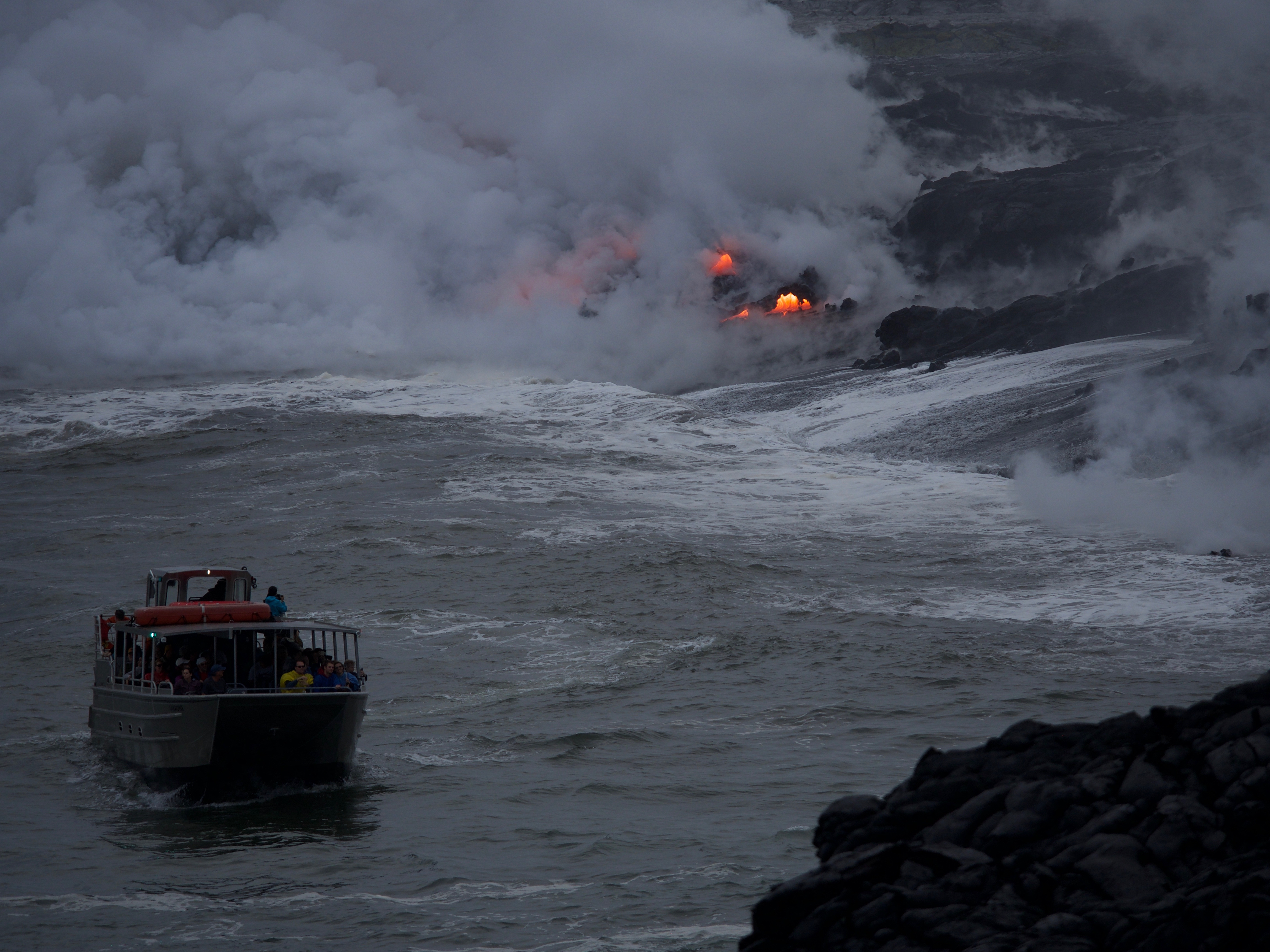
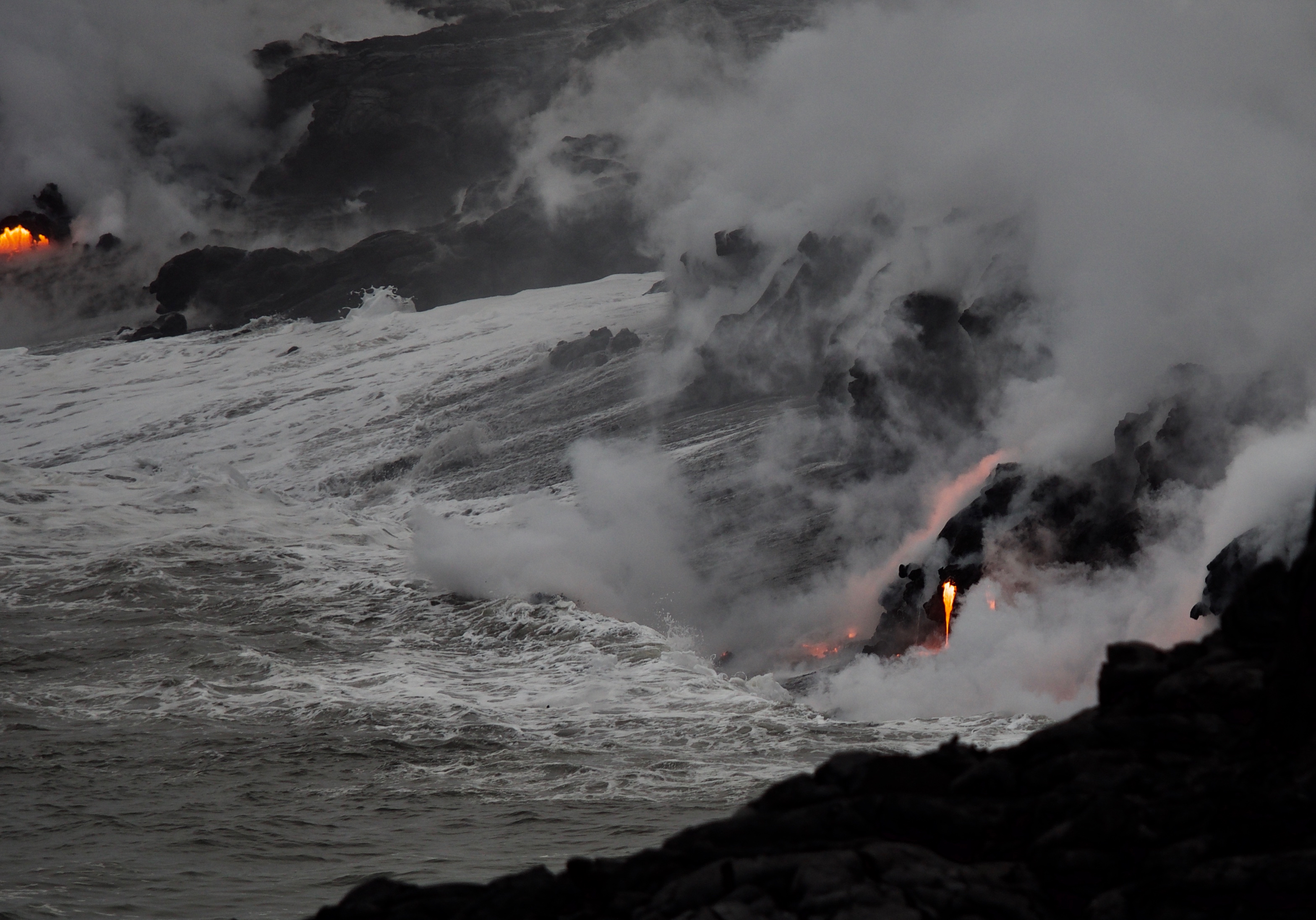
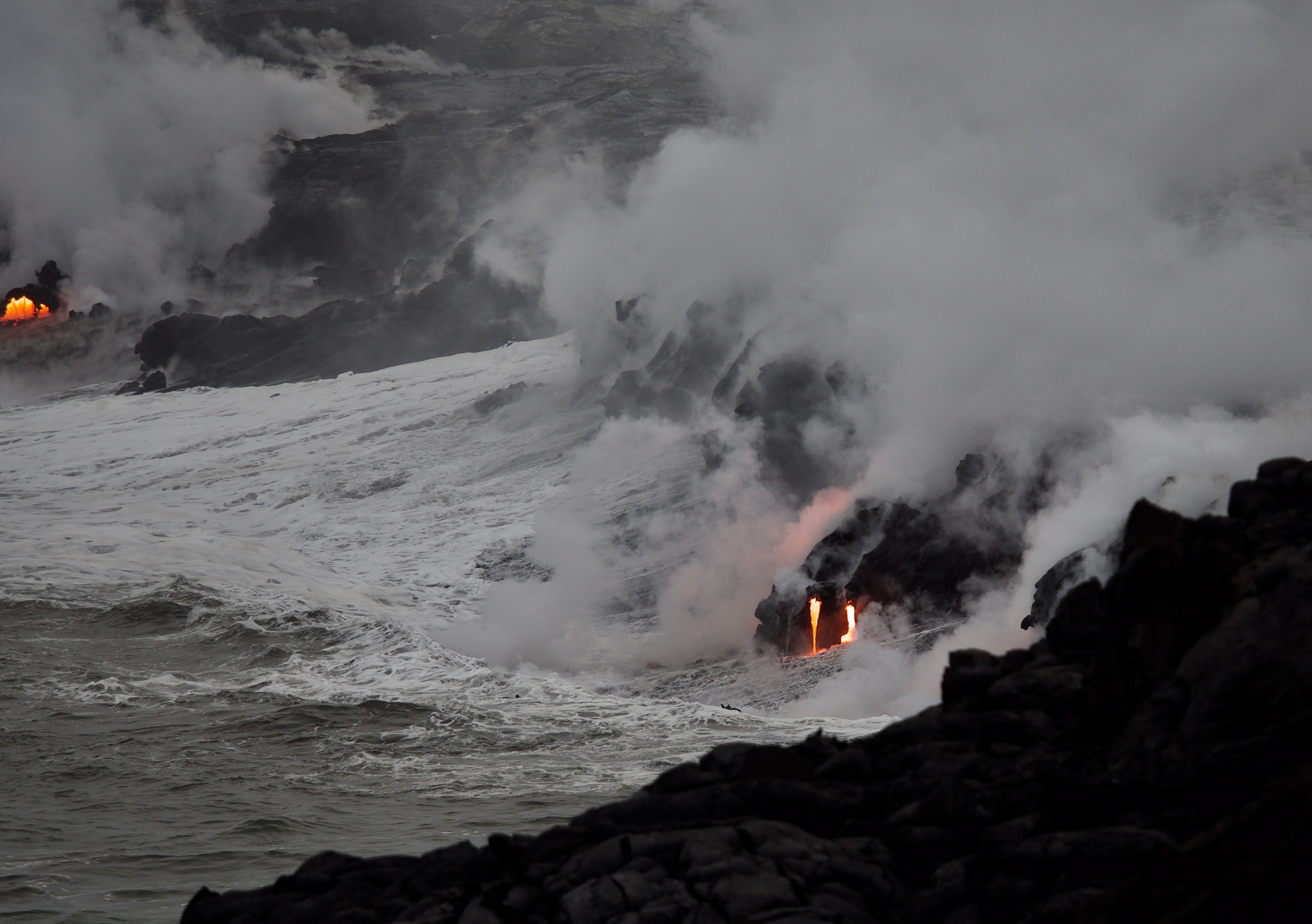
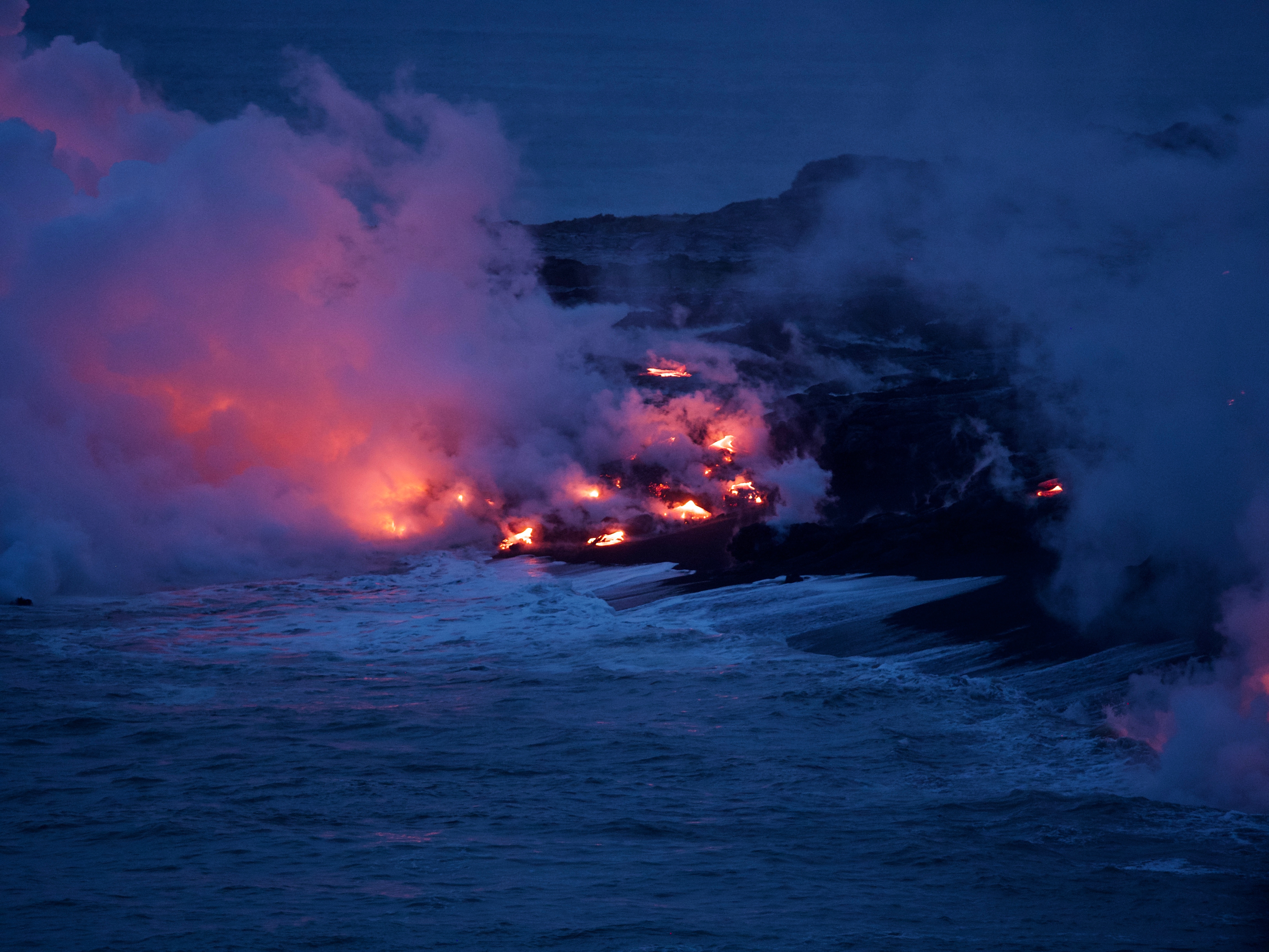
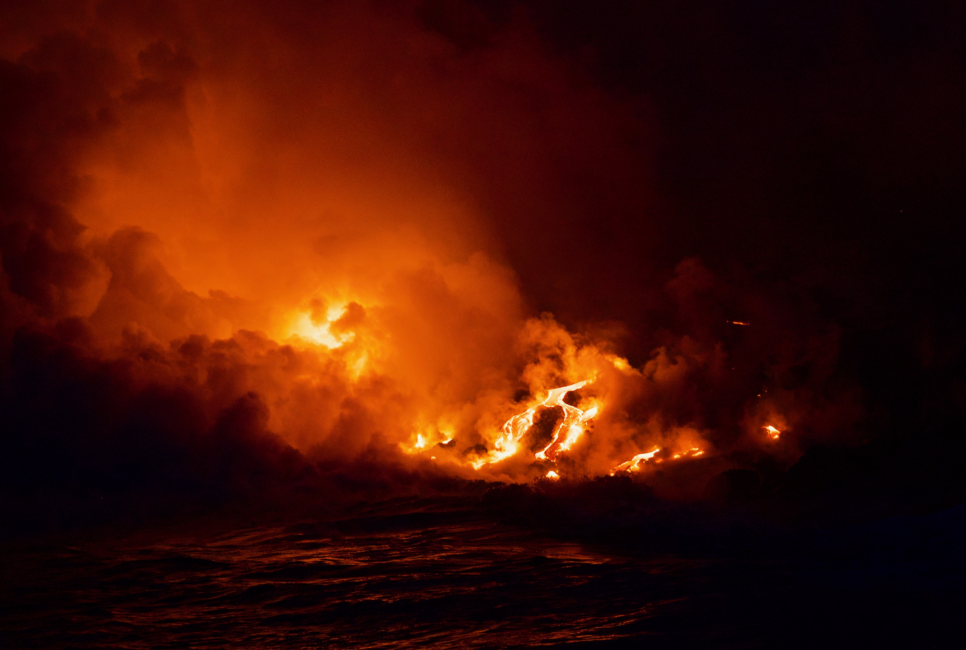
We parked and hiked from Doc’s across the endless black lava from the 1983 Kilauea eruption (which had activity off and on for 27 years, then stopped, and has now produced this little flow) until we reached the roped-off area on National Parks ground about 2 miles in. Then we clambered down to the area with the active flow into the sea, which was visible in the daytime, even with the steam cloud that obscured most of it most of the time, and then also up into the lava field above, where we knew there wouldn’t be active lava, but some steam vents and an area where we could see the heat shimmer through a crack below. The ranger we talked to estimated that the lava tube is about 10 feet below the surface–at this point, there is no lava visible anywhere in the area except where it meets the sea. That’s of course the spot we headed back to near sunset. We found ourselves a spot among the hundreds of tourists that accumulated–a really good viewing spot, as Mark’s photos show, so close to the cliff drop off that some people didn’t want to be there–but we were on this almost impossible to skid on lava surface AND sitting down! We stayed there for about an hour just watching the constantly changing flow of the lava, the waves trying to “extinguish” the lava (in vain, of course), rocks flying, lava splashing–it was just mesmerizing. Then we climbed back up across the lava to the dirt road in the dark, with the help of flashlights and iPhones–it was fun to see the endless string of headlamps, bike lights, flashlights, and cell phone lights before and after us, as people were still coming and others leaving, many on rented bikes, about a quarter or so on foot, with only a parade of blinking lights visible. We were back at the car before 8, and then drove home, eating our picnic lunch as dinner on the road. We took a different route (Route 200 across the middle of the island, going between Mauna Kea and Mauna Loa) this time, which we knew had construction, but was shorter, and since it was late enough not to have a lot of traffic, we still made it back home in about 2 hours, by 10 pm–we were good and tired by then, especially Mark, who did all the driving, but what a great day! We had some rain on the way home, but that was the first real rain we’ve had–and it was incredible that it held off while we were on the lava fields, making a perfect day even more unbelievably perfect.
Postscript: On December 31, two days after we visited the lava flow viewing area, both the east and west areas were closed by the national park service until further notice after a massive collapse of the lava delta that we were watching with such fascination!