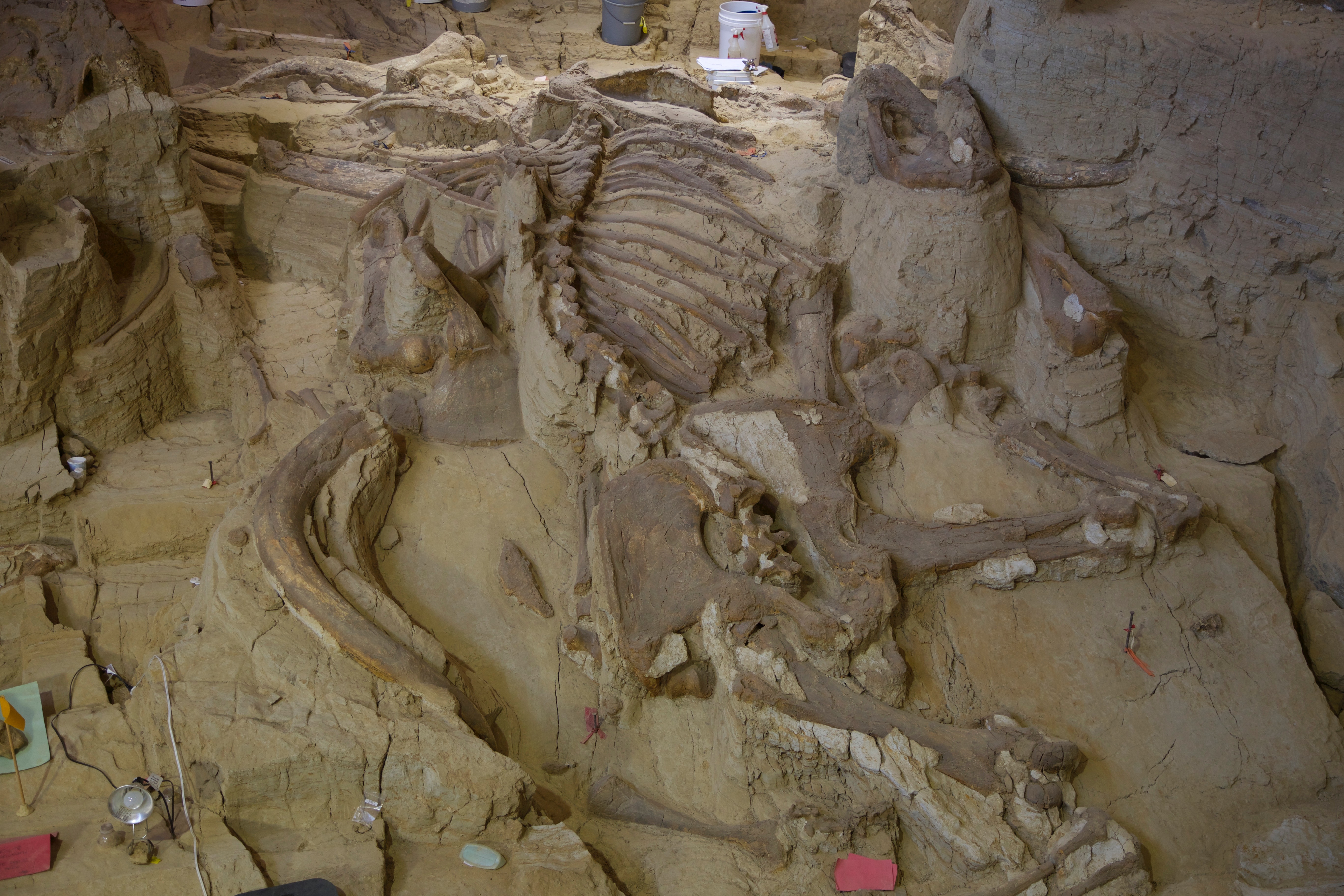
Wow. I think this day took the cake as far as exhausting, overfull travel days are concerned. It was a combination of “let’s do the interesting-looking travel stops” and major driving day, because the distances between seemingly close places in Western South Dakota are really quite daunting. So: We started the day out with a 7:30 hotel breakfast (again, nothing to shout home about) and a visit to the Mammoth excavation site right next door to the hotel. It boasts that it is the largest covered in situ excavation site, but we thought that Ash Falls, otherwise rather different, is just as large. It was, however, impressive, although the guided tour was a bit on the boring side (supposed to meet everyone’s needs from 5-year-olds to 95-year-olds). The site is a former sinkhole in which primarily mammoths (Wooly and Colombian) and a few other animals died because they couldn’t get out, and they have found remains of 61 mammoths so far–some of them astonishingly complete. The work is still going on, and they have a summer volunteer program (through Earth Works and Road Scholar) so that every “excavation season,” they have plenty more to catalog and work on all year long.
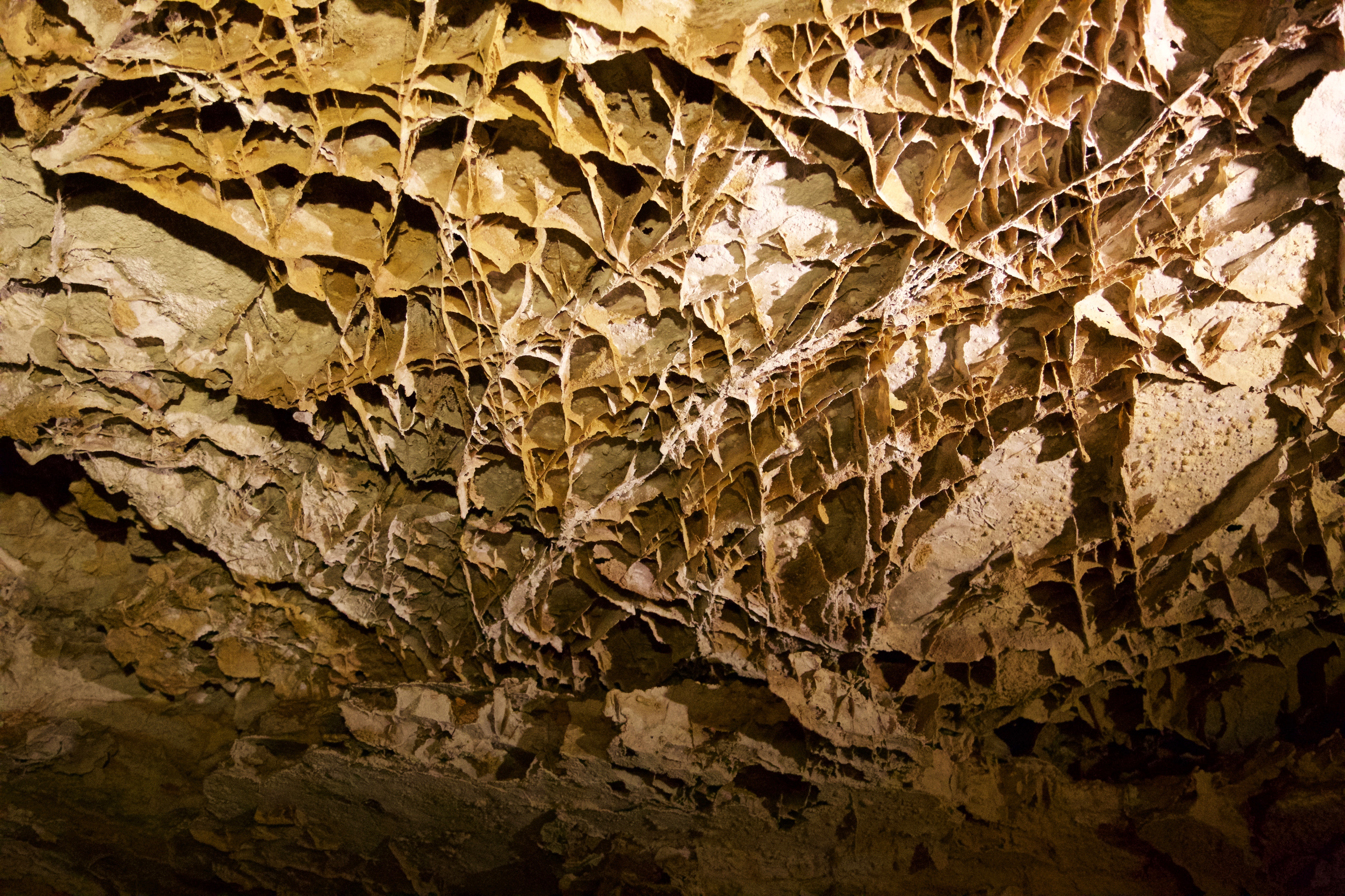
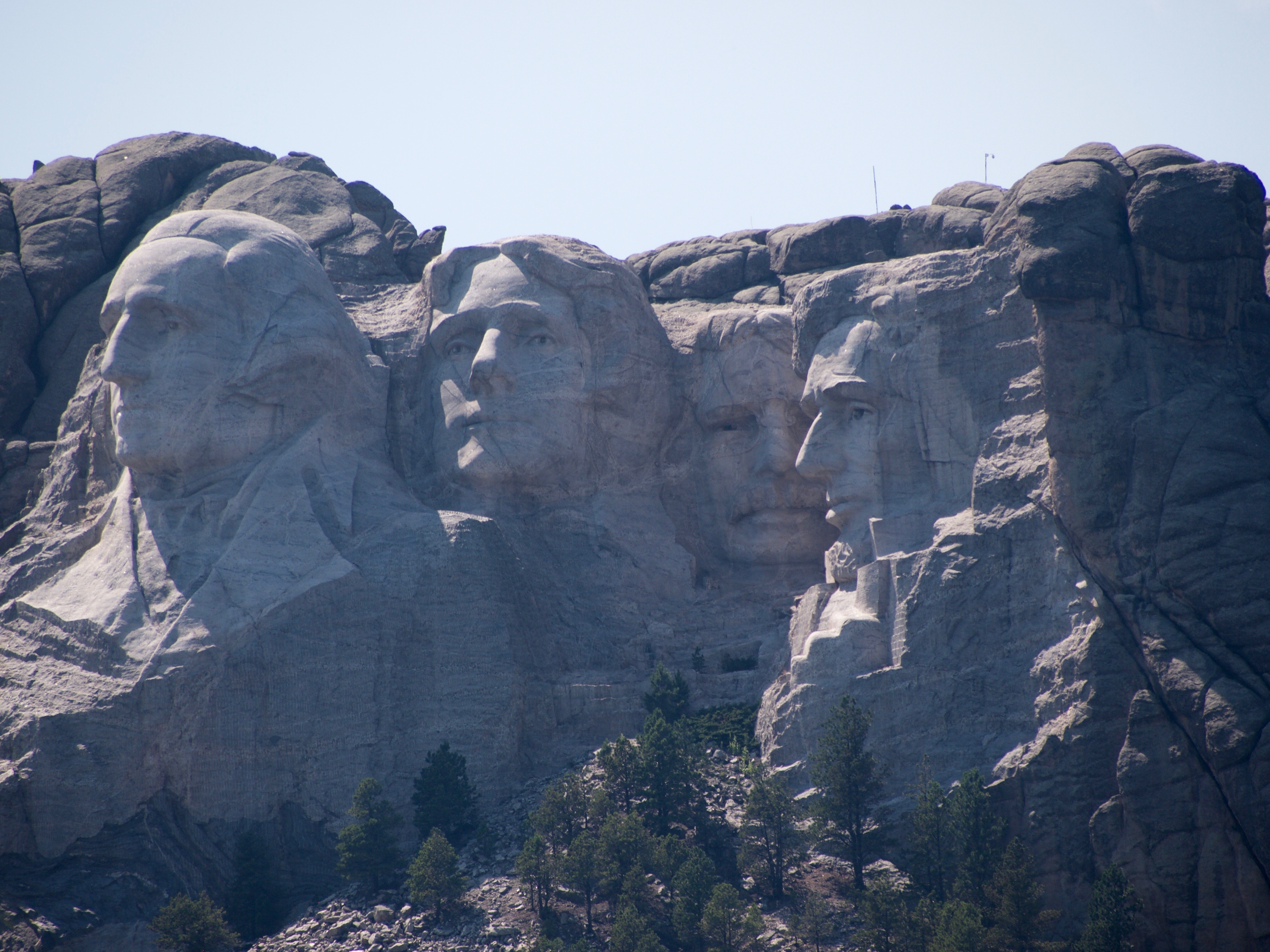
After our brief stop at the Mammoth site, we drove to Wind Cave National Monument, and got a tour within the hour (quite a feat, given the many people that were milling around even at 9:30 in the morning, and that the tours are all first-come, first-serve). Wind Cave was astonishing to me, even though it doesn’t have any of the usual beautiful features of a classic limestone cave. It is an almost completely dry cave, and so there are no stalagmites or stalagtites etc. But it is absolutely massive–one of the longest, and of the most complex cave systems in the world, with 142 miles of connected cave trails and tunnels and rooms explored so far–and walking around in just the teeny bit that we got to see in the 1.5 hours of our tour was very cool. Lots of side “branches” all over the place, and most notably these fascinating formations called “boxwork,” which is really the patterns of the material that used to be the water (mixed with whatever made it calcify) in the cracks within limestone that has long since eroded. The guide explained boxwork very well by comparing them to mortar being left intact if you could melt the bricks in between, and pointed out that 95% of all the world’s boxwork is to be found in Wind Cave. Its spiderwebby patterns are really beautiful, but it’s hard to photograph. We got out of the cave at about 11:30, and then drove the short distance to the next nice picnic spot in Custer State Park, to have our picnic lunch, this time enhanced by some trail mix we bought at the nearby park gift & convenience store. We then checked out a panorama point in the park, near a fire tower–it wasn’t a very clear day, but with Mark’s tele, we could spot Mount Rushmore from a sideview (Washington only) and also the half-finished Crazy Horse monument). We then drove the beautifully scenic route toward Mount Rushmore through the park because several people had recommended it highly; it is called the Needles because of the needle-like formations near the highest point of the road, including one called the Needle’s Eye for obvious reasons (see photo), although the tunnels that were on the route could also have been seen as the eyes of needles through which several bigger SUVs barely fit! The route was as gorgeous as advertised, and showed both the foresty and the interesting-formation aspect of the Black Hills. But I have to say that beautiful landscapes tend to pale a little after what we saw in Yellowstone! We passed Mount Rushmore around 1:30 pm, and, as planned, didn’t actually get out and clamber around. I was very glad–it was beastly hot (95, 96 degrees) by now, and I have to say I think that the whole concept is a bit ridiculous and that I didn’t care much for the whole monument–but we did stop at a pull out and took a photo from afar, and I was surprised that the profiles are actually smaller than I thought they would be. All I could think of was how Cary Grant and Grace Kelly climb around on them in “North by Northwest”–there was actually a big marker reminding us of this fact right outside of the monument!
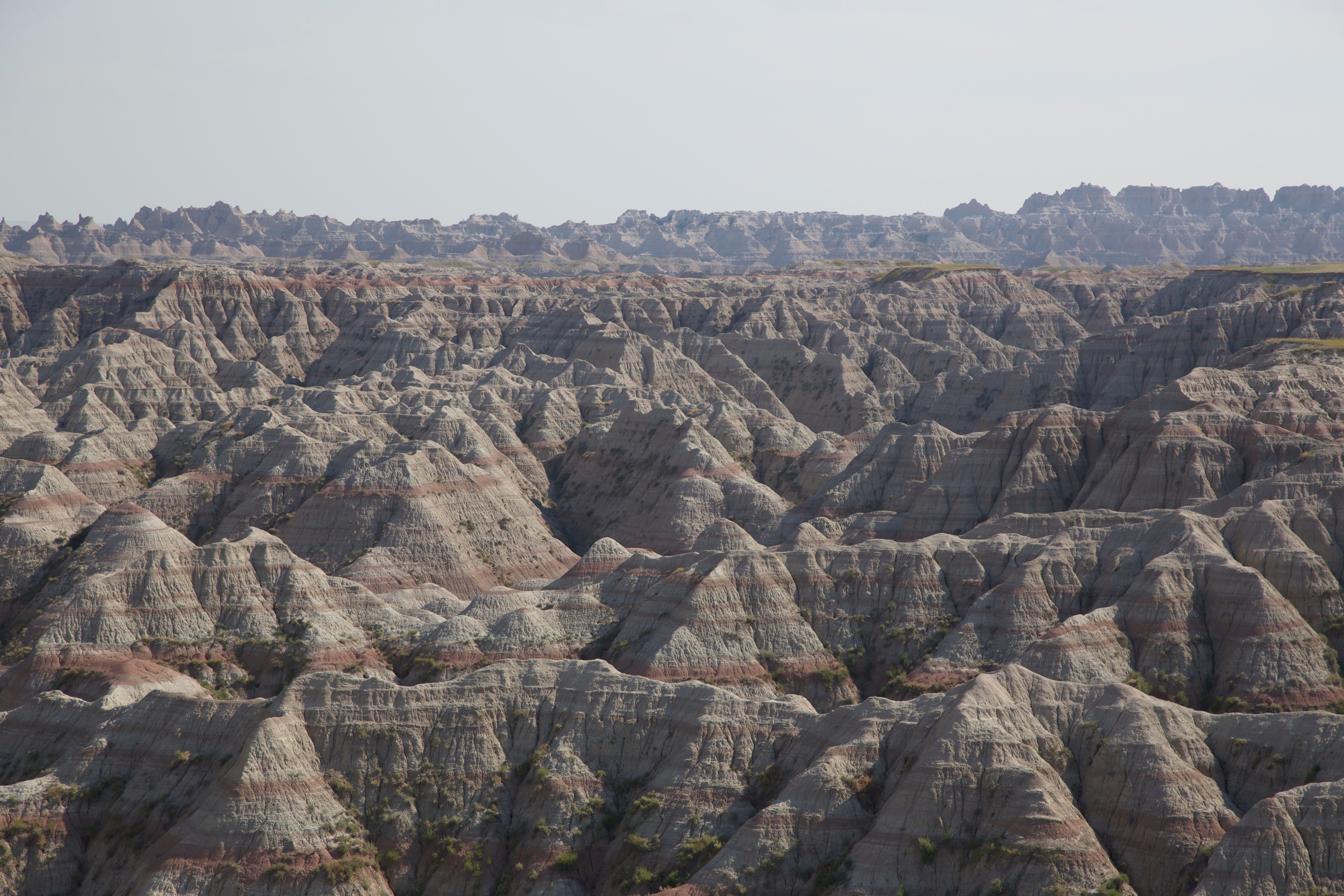
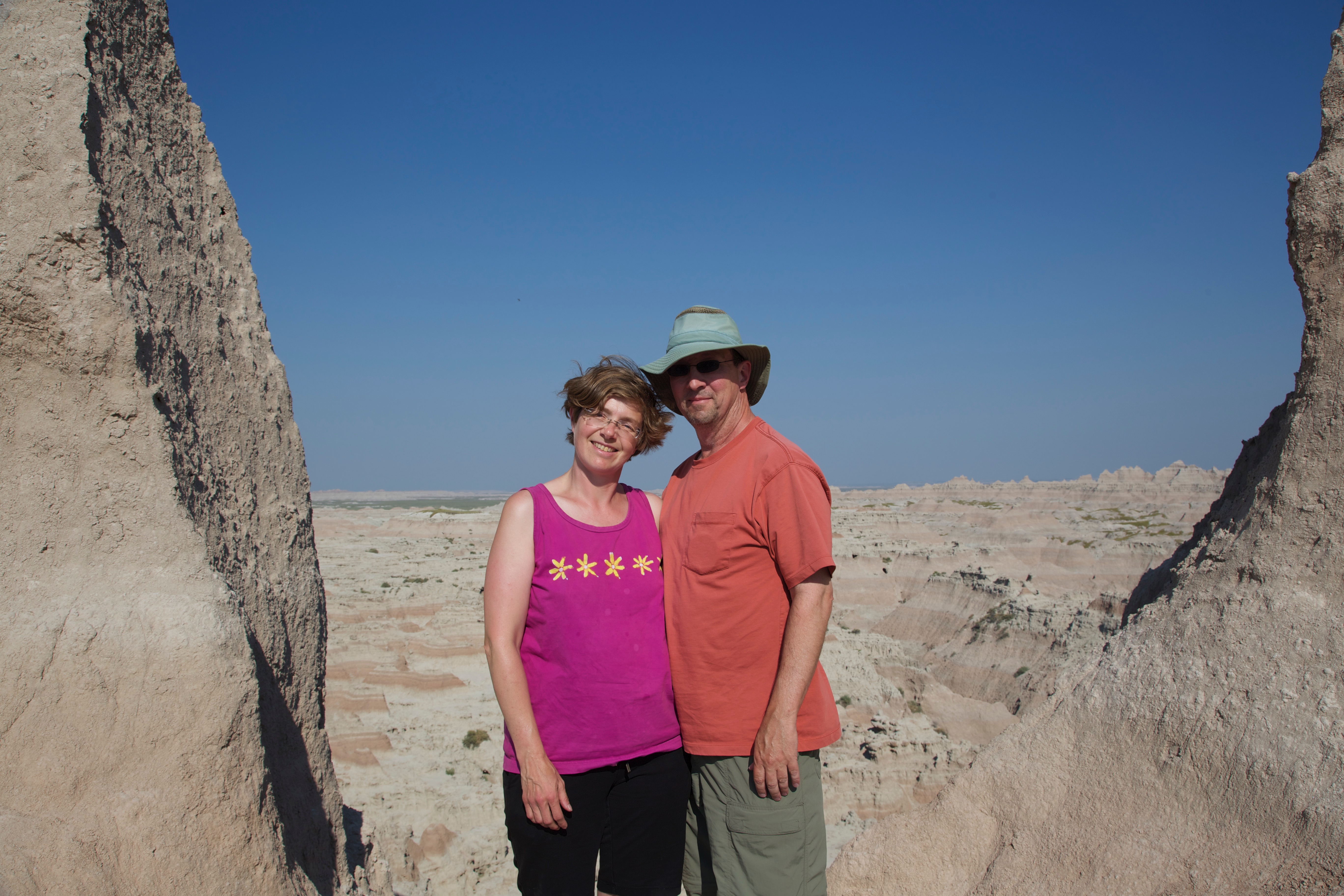
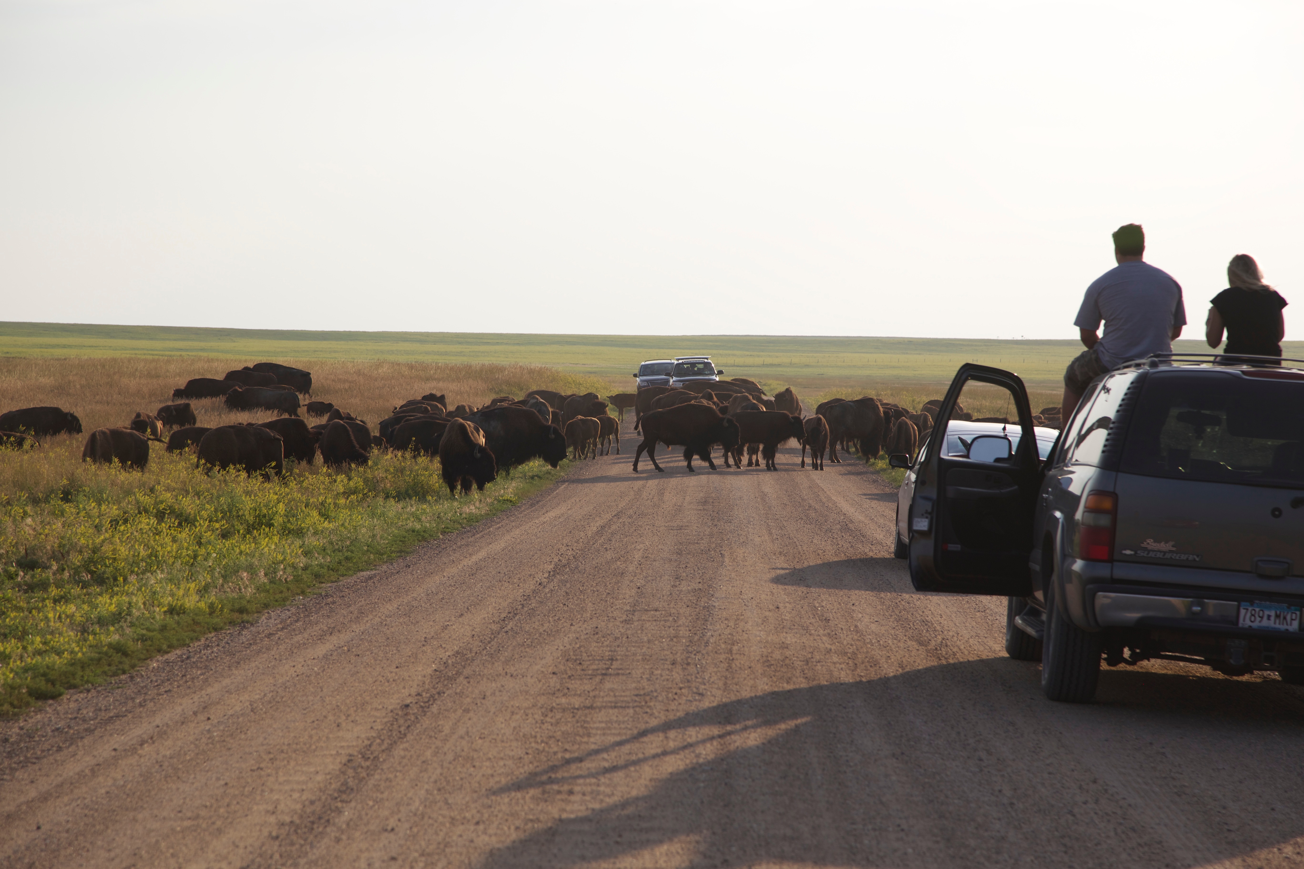
From Mt. Rushmore, we drove up to Rapid City to reach the Interstate (I-90) and take the fastest (if rather long) route to the Badlands, which we reached in about 2 hours’ time by about 5 pm. We took the driving tour, the so-called Badlands Loop, which weaves in and out of the Badlands “Wall” that separates the higher and lower layer of prarie land, and because it was still 98 degrees, we only got out for short walks at various panorama points and interpretive trails. It is a stunning landscape, not only because it is so vast, but also because it is so obviously always in (slow) motion, since the badlands formations are so soft and crumbling away constantly–even worse, I would think, than in Bryce Canyon. Obviously, it was basically pointless to NOT walk around in the formations, because every rainfall reshapes them and creates more runoff, so unlike in other National Parks, we were clearly free to clamber around everywhere. It was neat to see the different layers of the different geological periods; given that some layers are apparently very fossil-rich, we were a little disappointed that we didn’t get to see any fossils, just fossil replicas and other educational material like that. But the views were beautiful, and given that it has rained quite a bunch more here (just as in Yellowstone and Colorado) than in the past 20 or so years, I am sure that the prairie in between the different Badlands layers was much greener than it usually is. At the end of the loop, we added on a bit of gravel road and got to see some antelope (we think) as well as a couple of additional outlook points, but we eventually had to backtrack rather than to add the suggested gravel road loop because a small herd of buffalo had decided to hang out right across the road, not showing any preference for either the left or the right side. We watched them for a while from a distance in the beautiful evening sunlight, but eventually drove back the way we came rather than trying to wait until they had cleared the road.
For dinner, we chose a ridiculous road-attraction cafe that is part of the “Wall Drug Store,” which advertises for miles and miles around with huge billboards that it has 5-cent coffee and free ice water (its gimmick since it was opened in the 1930s, before the interstate was even there) and that it is the biggest drug store ever. Well, they served perfectly fine hamburgers and had a huge collection of knick-knacks and touristy stuff, and we were there just before they closed at 8 pm, so we were happy. Then we drove the long two hours back to Hot Springs and wrapped up our day very late, compared to our normal bedtime. Tomorrow, we begin our trip back to Nebraska, albeit with vacation stops.