

The NPS map is nicer, but this gives you an idea of our morning drive (with many stops)
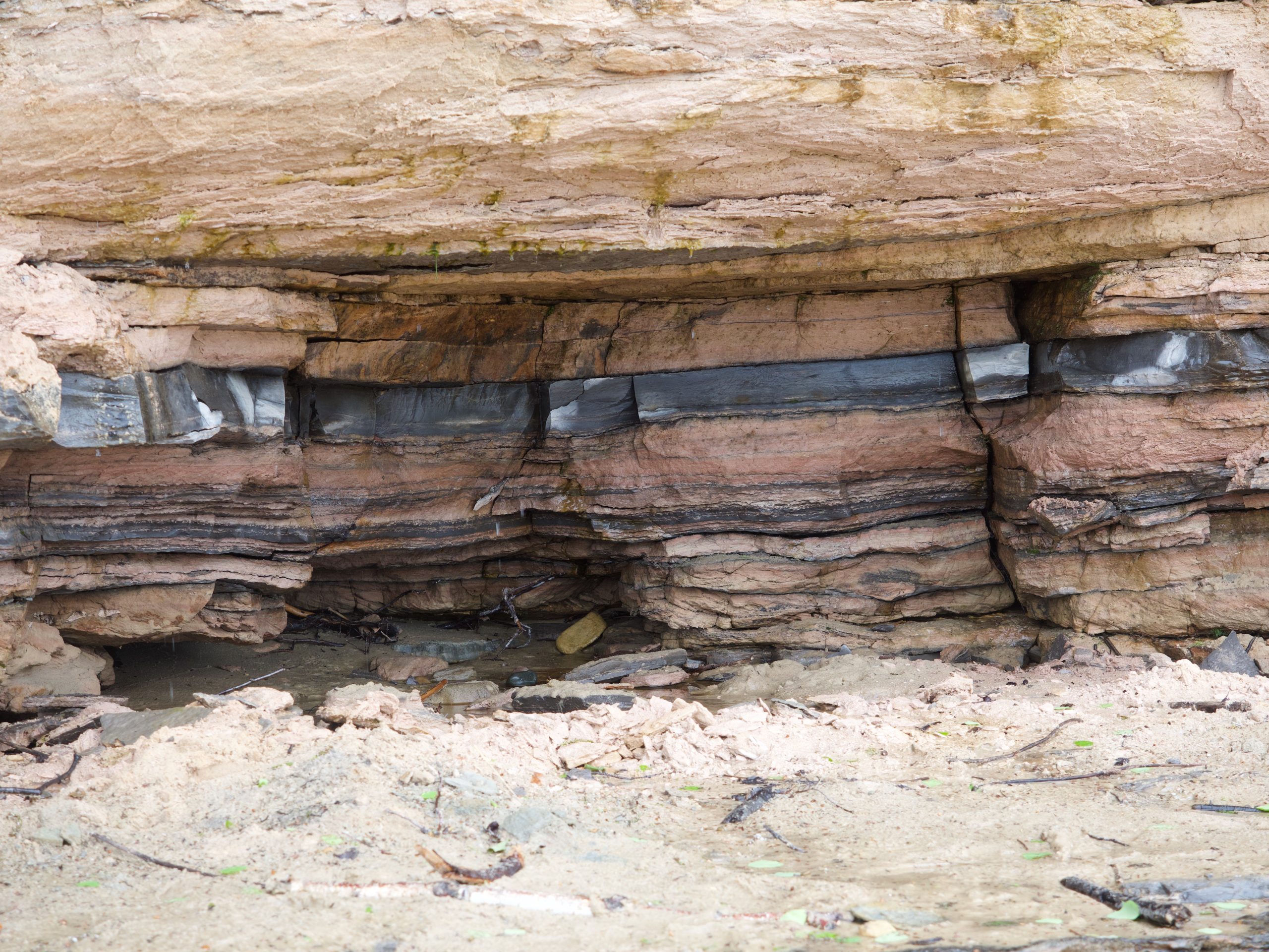
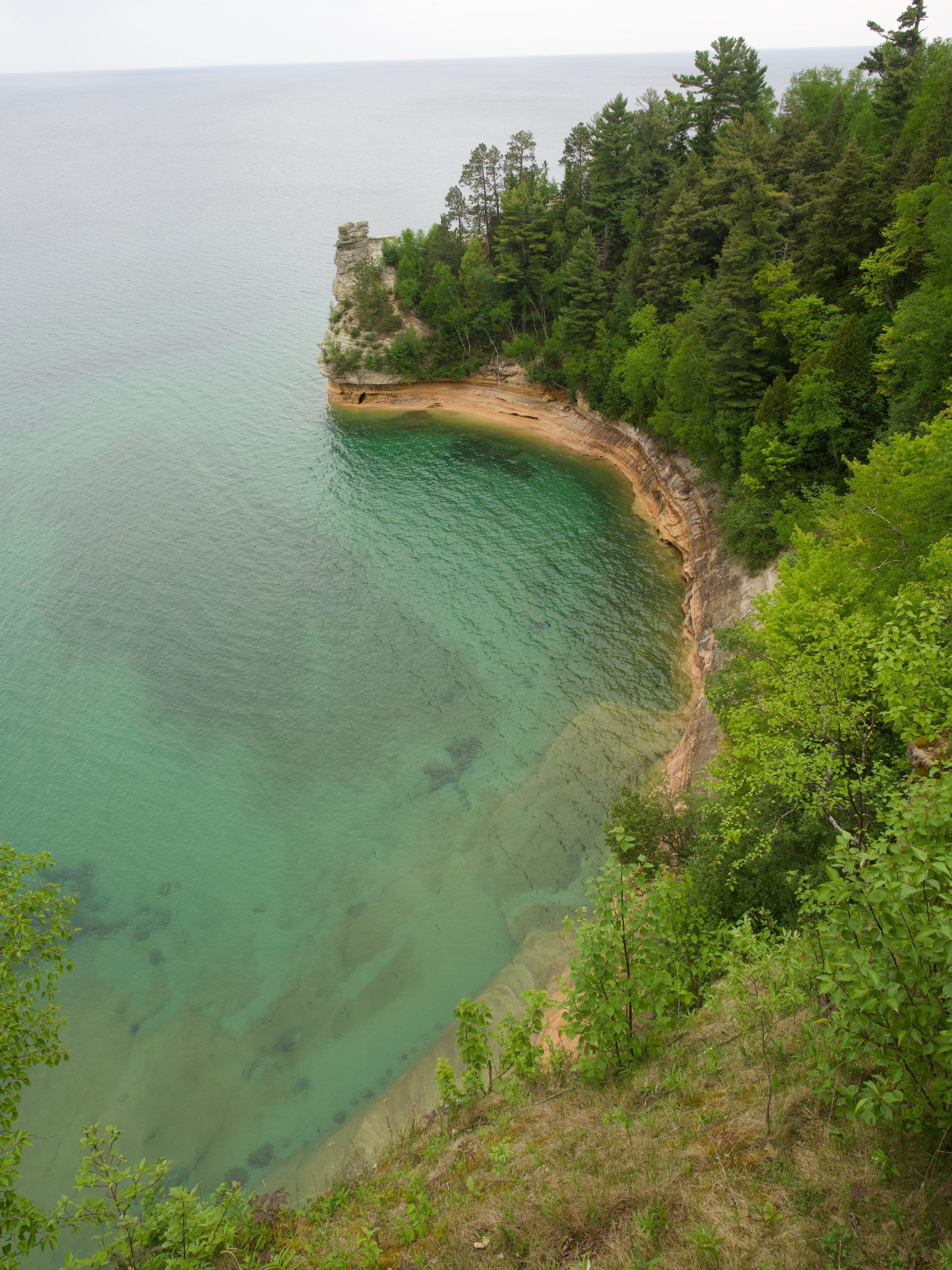
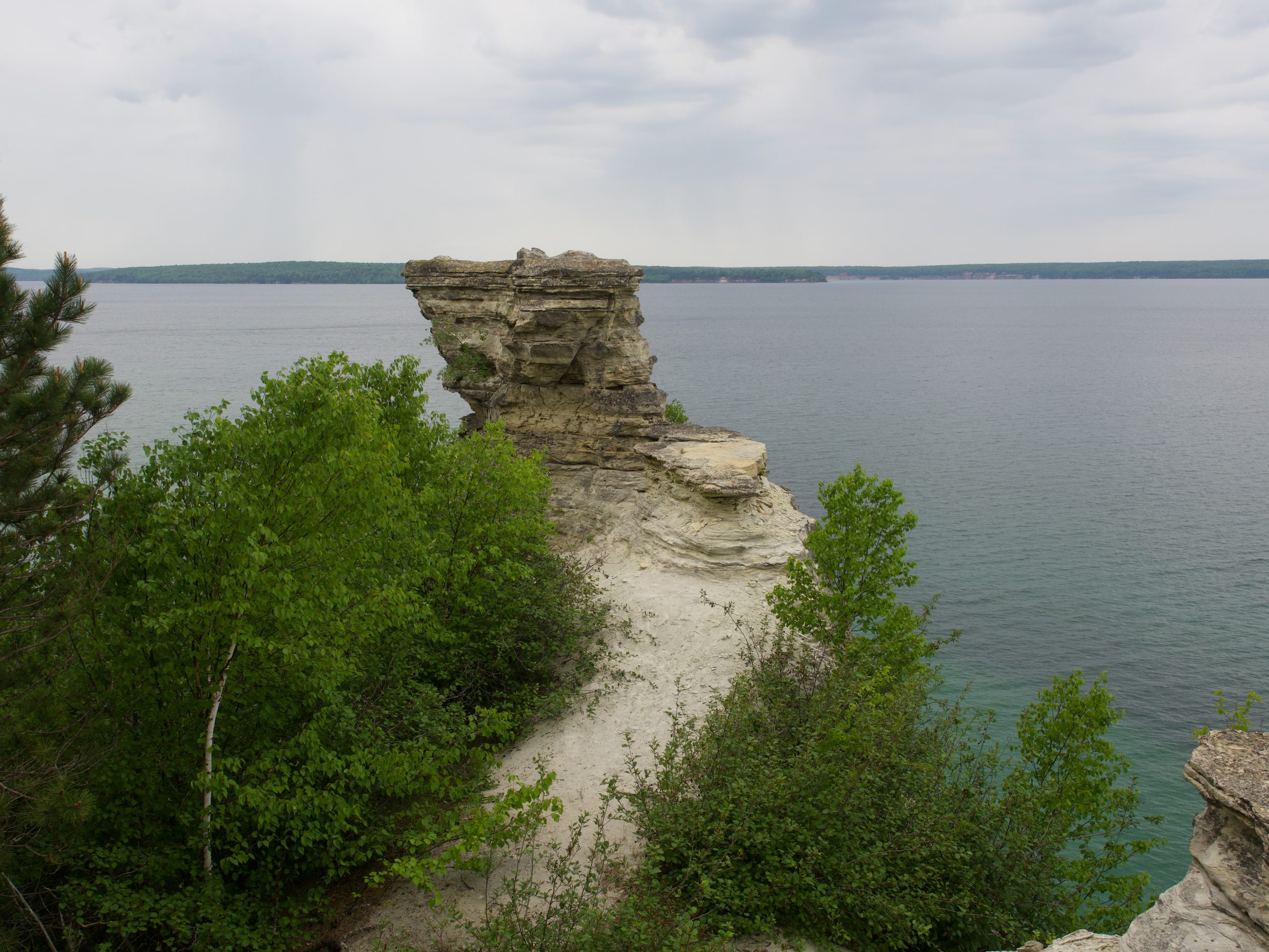
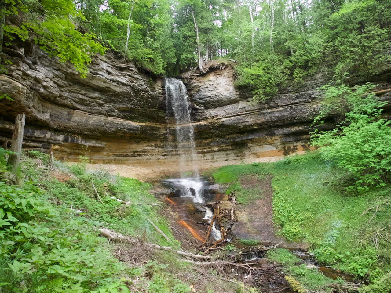
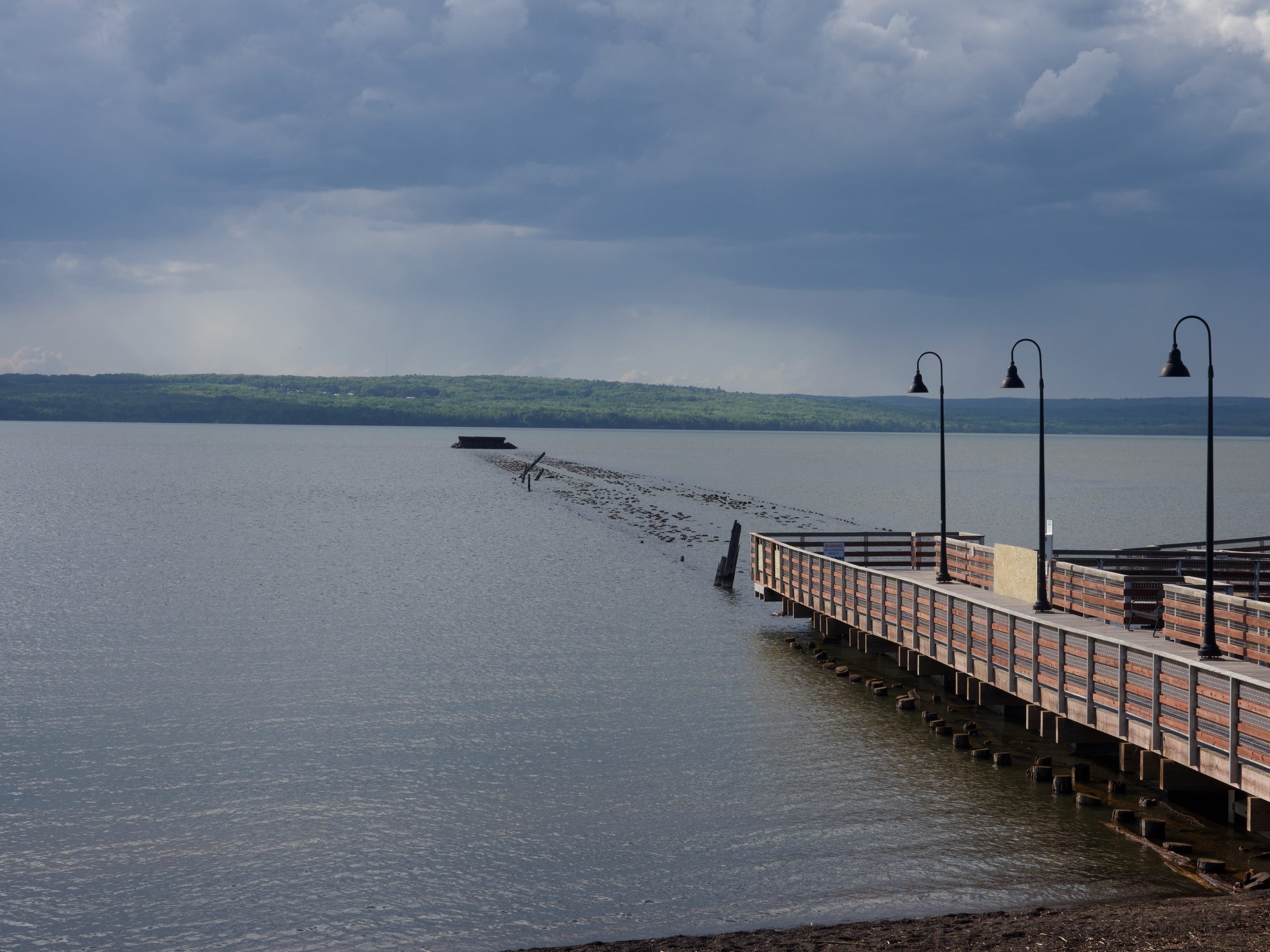
We got up bright and early, got ourselves packed and ready, and left so that we would be inside the Pictured Rocks National Lakeshore by 9 am when the visitor center on the East side of the park opened for the first time in the season! They were a little rusty in their routines, but we got our map (we have our lifetime National Parks pass already, and we have the priceless NPS app with the option to download the park info we need when signal is spotty! This particular park at this time early in the season was very quiet, especially on the east side–we probably saw fewer than 20 people at the first three or four sites we visited, and then a few more at the last two or three. But still probably under 100 people total–I kept expecting crowds SOMEWHERE, but it was wonderfully peaceful and quiet everywhere, and the views of Lake Superior kept being stunning and the coastline beautifully varied–sand dunes, rock formations with gorgeous striations, lovely waterfalls, and the beautiful teal color of the water… and behind it lush forests (never mind some rather pesky mosquitoes and biting flies–we came prepared with long pants and bug spray, but are wondering how much worse that gets later in the season). It is really easy to forget that this lake is not the ocean–it is so big. By surface area, it is the world’s largest lake (by volume, it’s still # 3 and also holds 10% of the entire world’s fresh water). And when the weather is this gorgeous and the lake this calm, it is hard to imagine the storms and the winter ice that is so hard on the people who live here year round. Impressions from Pictured Rocks:
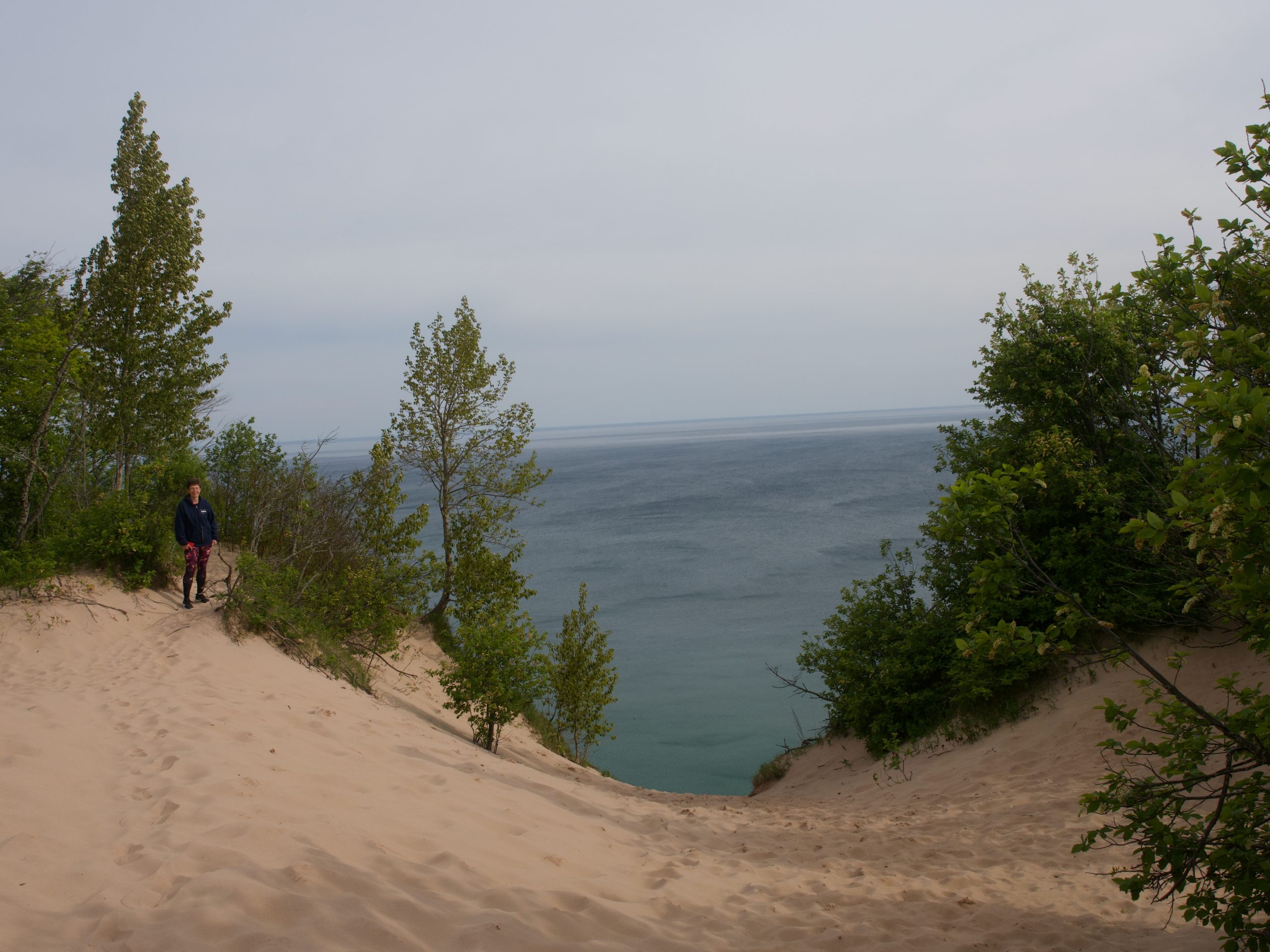
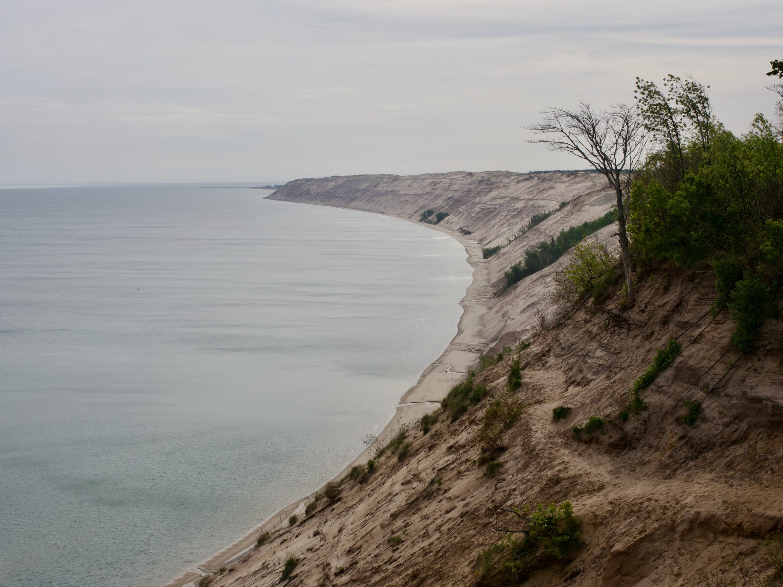
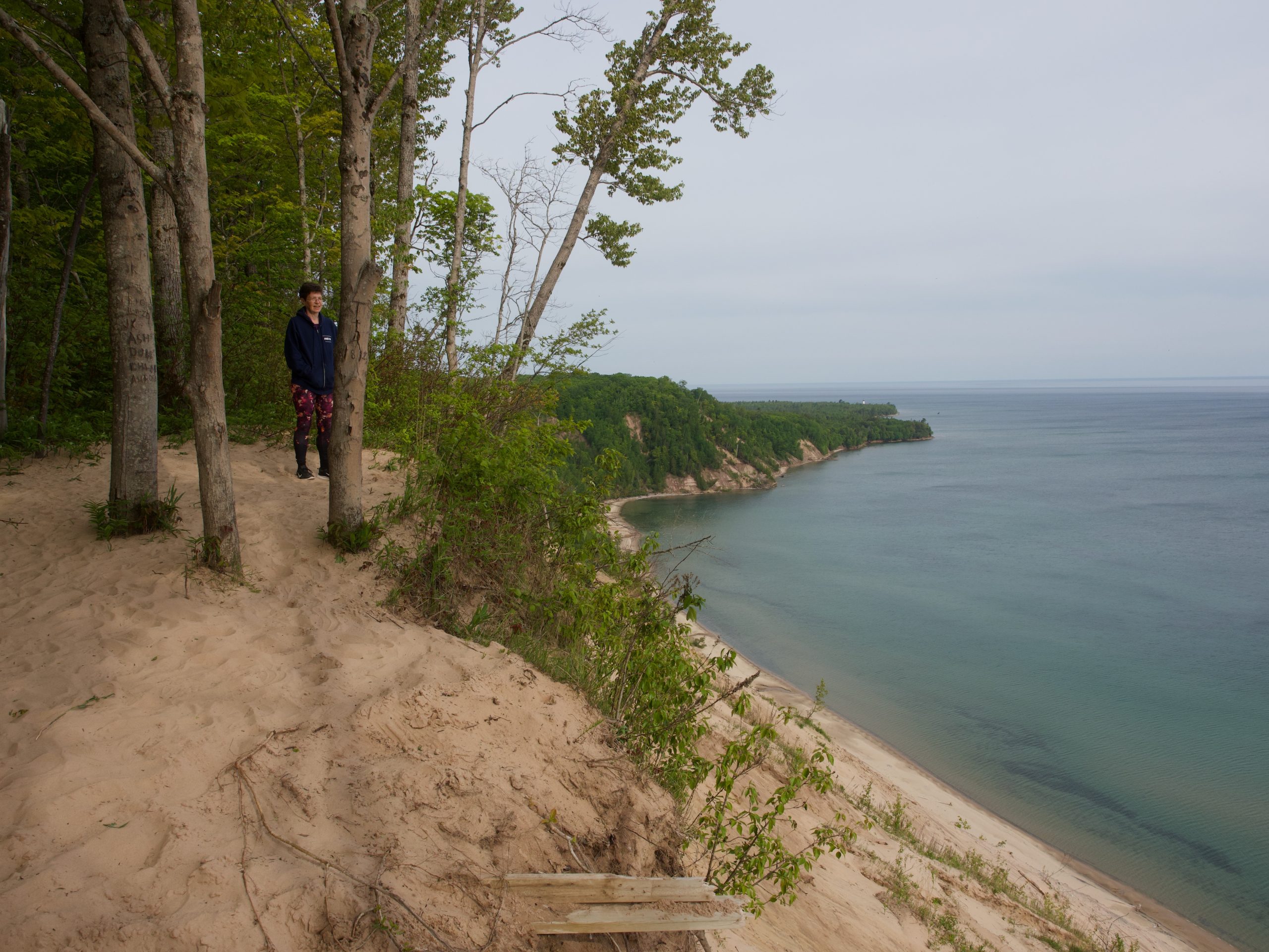

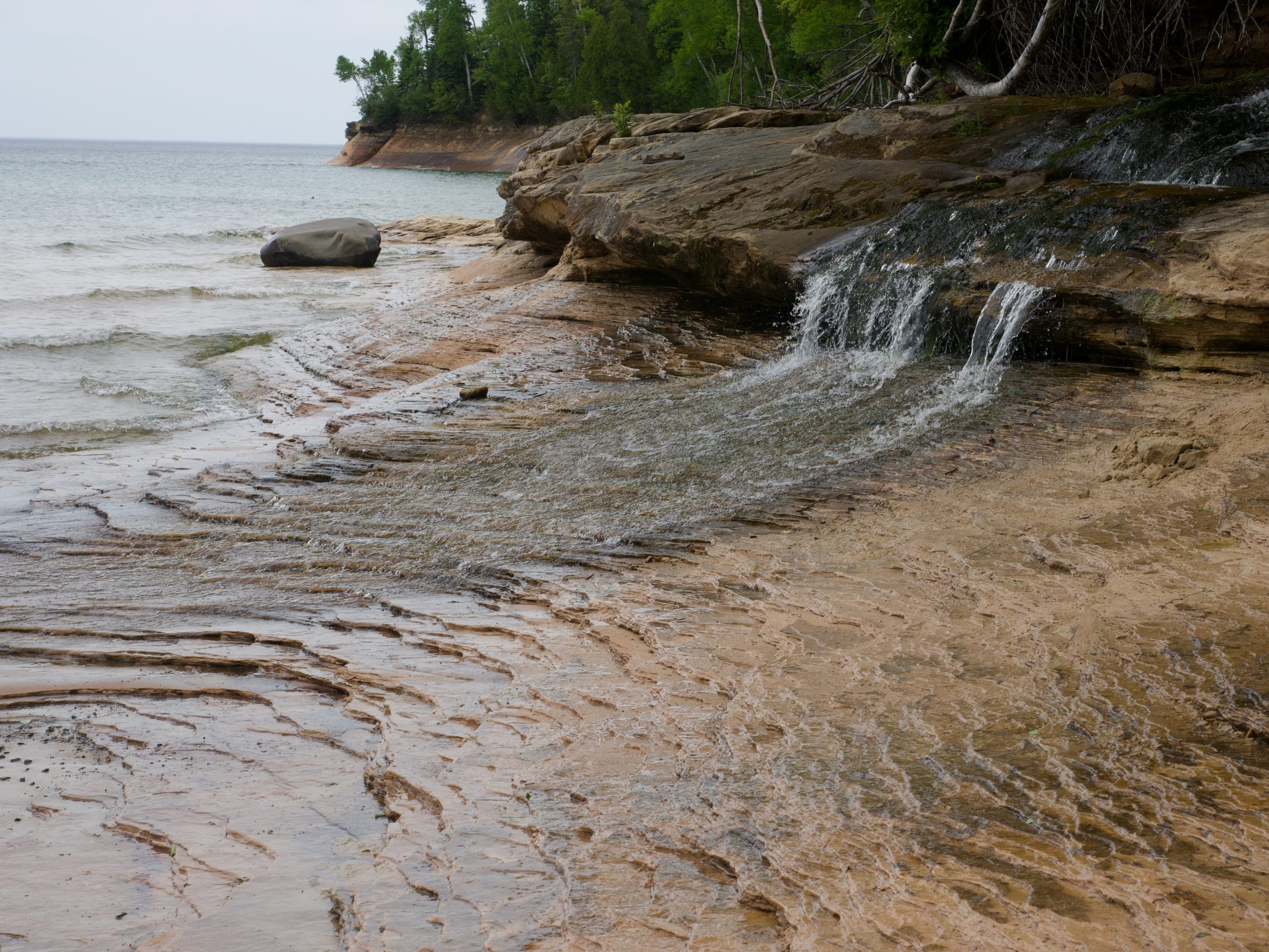
As these show, it was a gorgeous morning / early afternoon with lovely sites. We walked about 5 miles total but in little spurts, had our sandwiches at Miners’ Beach, and eventually left the park about 2 pm.
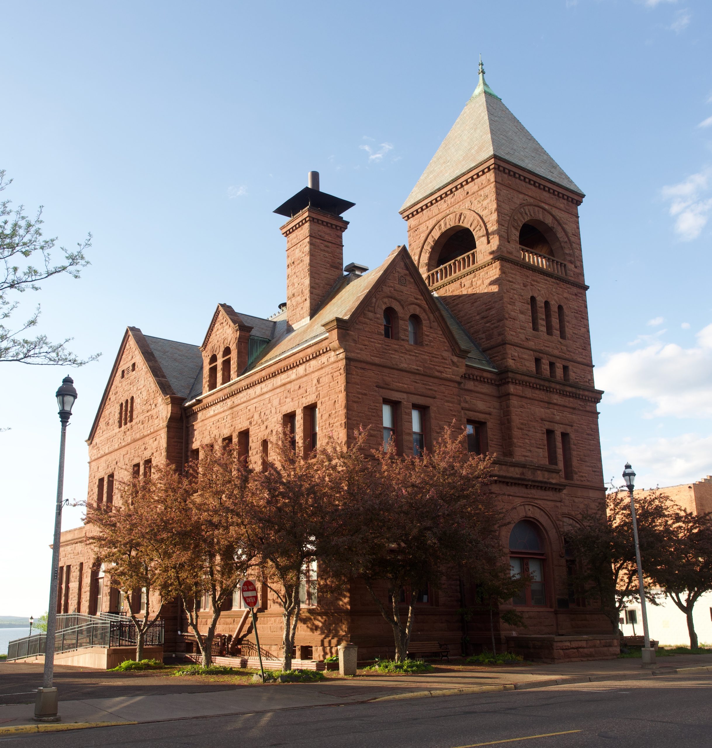
From there, we headed roughly west, along the lakeshore and through forested areas–all quite lovely, and with good weather except for one big old squall of rain, and no traffic. We stopped briefly in Marquette, MN (the largest city on the Upper Peninsula) to grab some yummy baked goods and a coffee) and then made our way to Ashland, WI, another town directly on the lake, formerly with a big harbor. This town of about 10,000, though perfectly fine, hasn’t impressed us, though. Another port city, once made relatively wealthy by the usual port- and lumber-related industries but now sustained by tourism, it has an ugly thoroughfare right by the lake, with fast-food chains all along. The main street is lined with several interesting historic buildings, including an 1893 red sandstone court house, but everything seemed really sterile. The hotel we are in is very new, with a sort of dental office vibe, and the receptionist very businesslike and impressed with herself–a jarring contrast with the adorable little no-frills motels we had the good luck to stay in the last couple of days. We had gyros and sweet potato fries at a little place that was NOT a fast-food chain, but for once, the portion sizes were actually too small rather than to big–admittedly, that meant there was room for frozen yogurt, but even that was fairly bland.
Well, we are only staying overnight and are moving on tomorrow, and if this is the only place in 10 days that we cannot recommend visiting, that’s not too bad!