The sun rose this morning at 4:41 am and we discovered that we can see it rise from the deck–but that we all needed a bit more sleep than that, so we went back to bed. But we were still up around 6 am because we were so excited about a day of hiking, since the sky had cleared, while it was also nice and cool as it usually is here even in the height of summer. The average high in July is 67 (19.6 C) here; yesterday’s high of 65 felt perfect and quite warm–although the 61 / 16C water temperatures are not inviting and we will likely not go swimming! But we are determined to get our feet wet occasionally.
A bit about Bornholm before I say more about our hike. It is a smallish island in the Baltic just east of the Southern tip of Sweden. It has been mostly Danish, with short time periods when it belonged to another country or city state. It’s been settled since the stone age (about 8000 BC) and historical records go back to the early middle ages and the Vikings. It’s only about 227 square miles, with about 40,000 people living here year round, in one small city, the port of Rønne, where we arrived last night, and little villages that are dotted all along the coast. There are many, many vacation rentals (and, I would assume, vacation homes that are used only part of the year) and about 600,000 visitors come every year, mostly from Denmark and Germany, and mostly in the high season–July and August. So it is not exactly an undiscovered hideaway, but it does not feel crowded or overrun, even though we are here in the midst of the busiest time of the year.

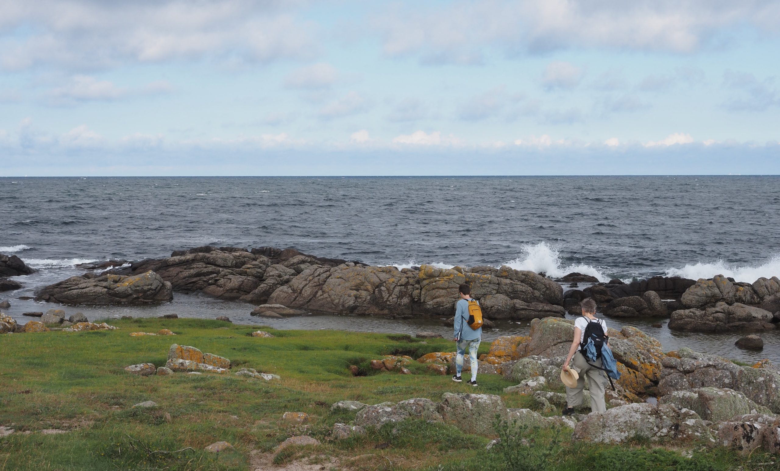
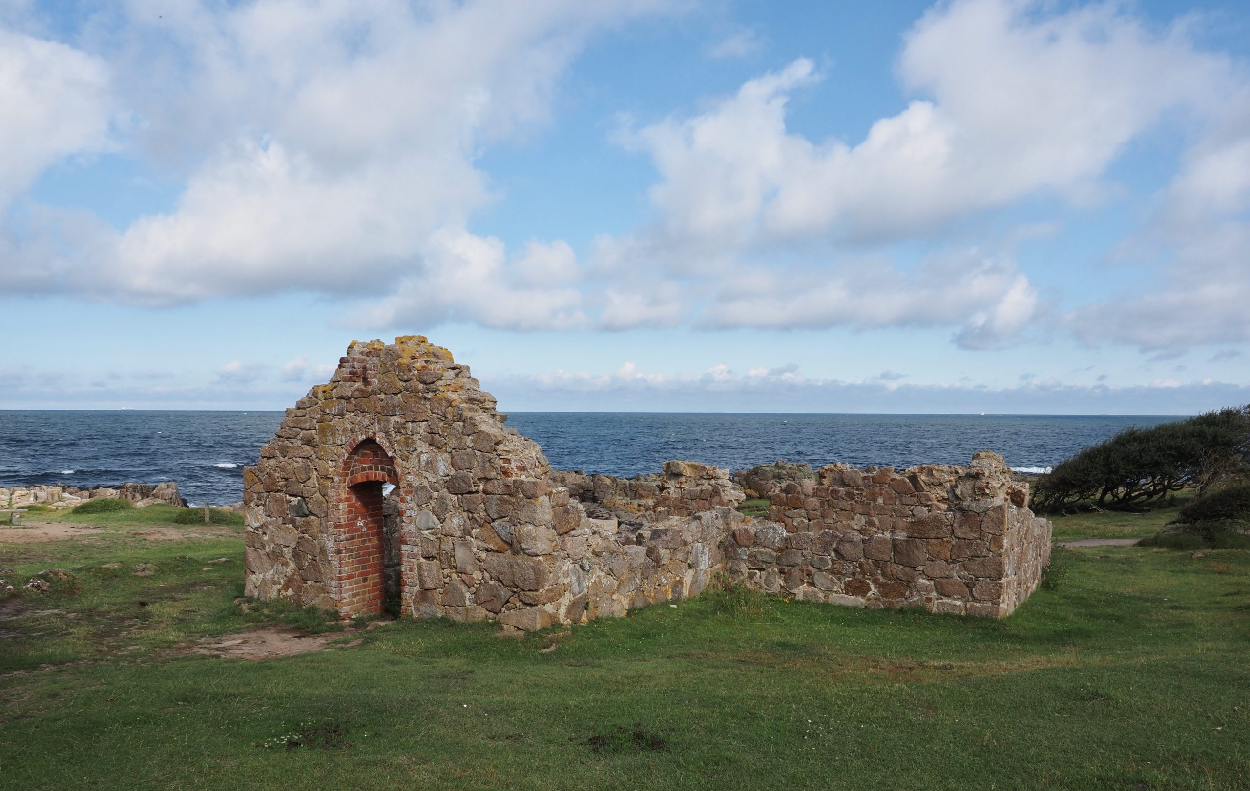
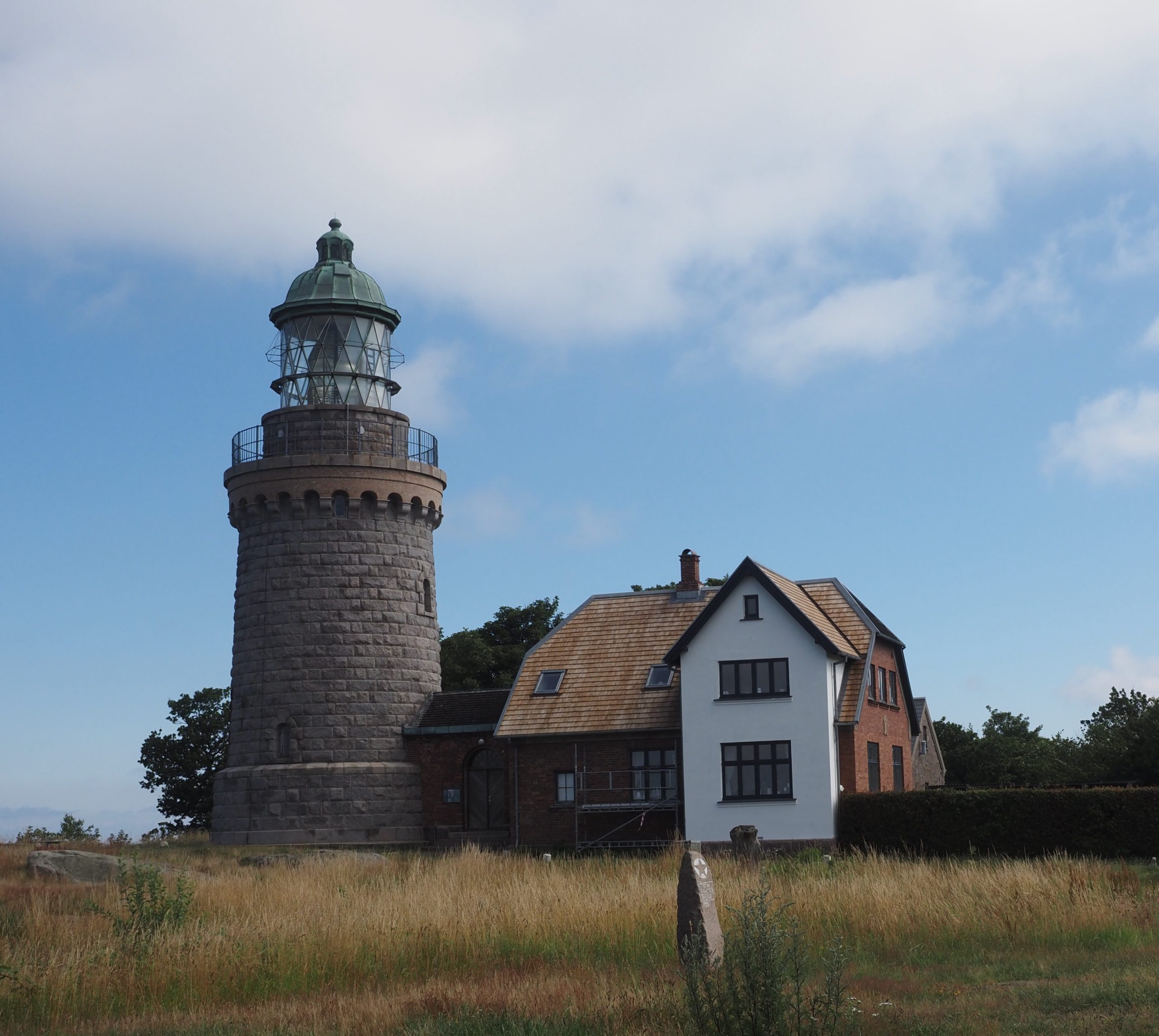
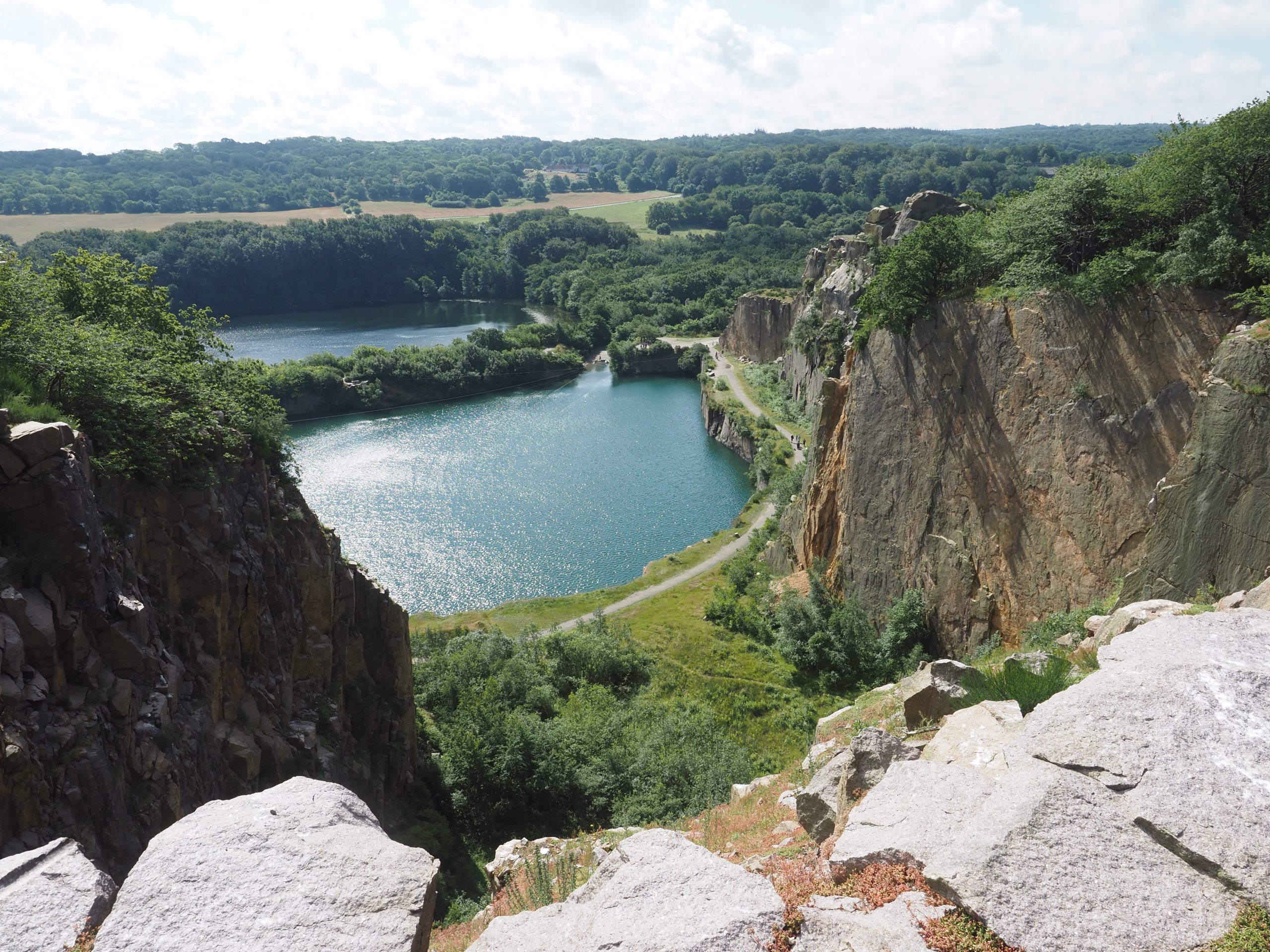
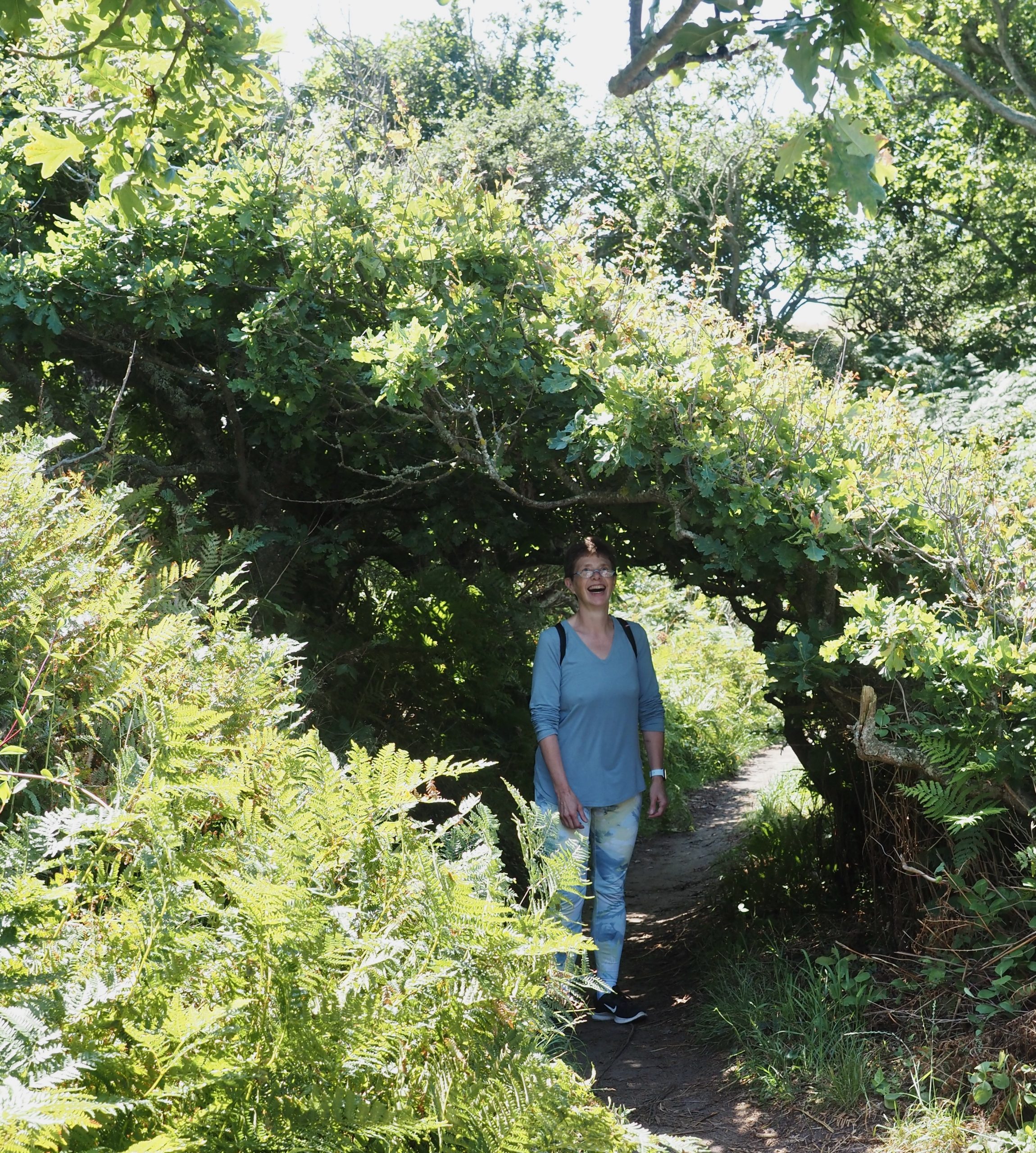
It certainly did not feel busy when we caught an early bus just after 7 am that took us about 30 minutes to the northwest to a town called Sandvik, and walked to a beach area just past the harbor to start our hike around a small peninsula in the very north of the island called Hammerknuben that is known for its rock formations and beautiful views. It certainly did not disappoint–the exposed granite that characterizes the north of the island makes for dramatic cliffs and canyons, and the hiking route hugs the coastline, much of it shaded by trees that often form a kind of tunnel but then open up to dramatic vistas. There were also two light houses–we were able to climb up the older, inactive one from the 1860s and take in the views–the ruins of a medieval church, known as Solomon’s Chapel, and a walk to a surprising view from a high clifftop into a beautiful quarry lake, from the highest plateau of the island (ca. 160 m. or 480 feet above sea level). There was a zipline going across the quarry lake and the squeals of excited teens could be heard a long ways away.

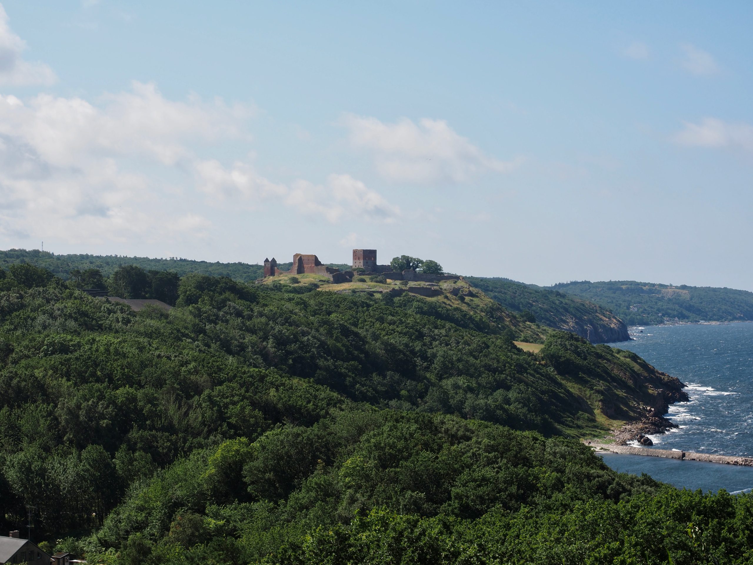
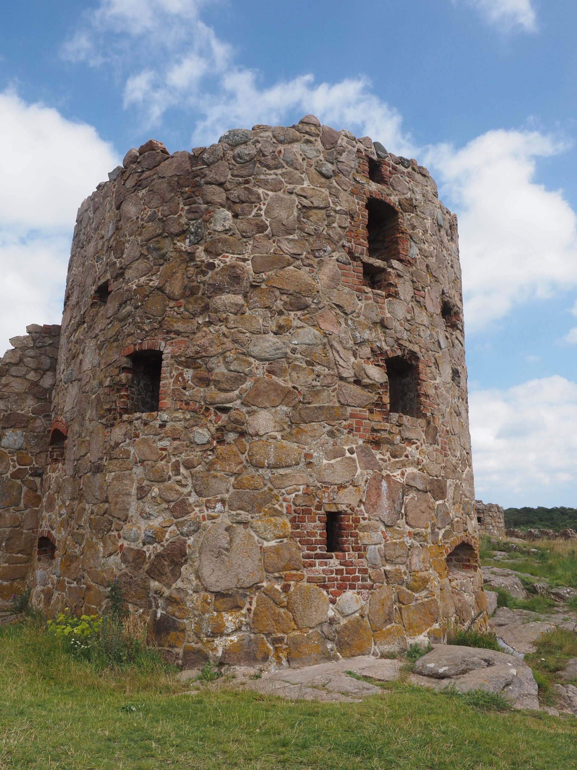
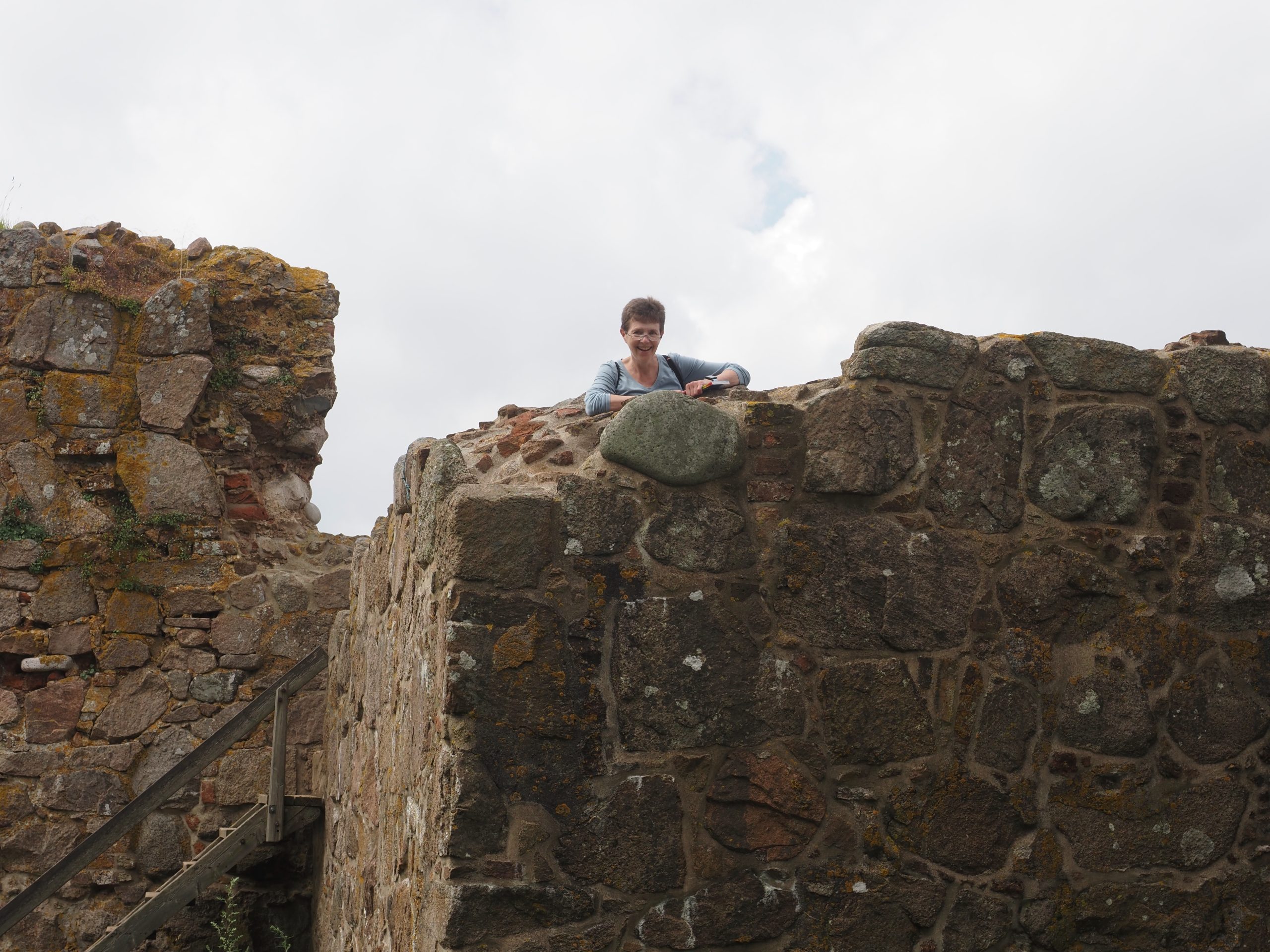
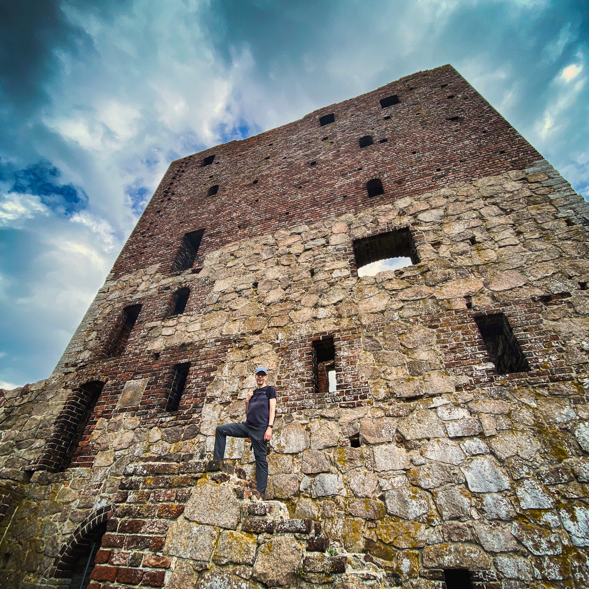
At this point we had walked about 5 miles (8 km) but the best part was still to come–we walked south from Hammersknuden to a tiny, beautiful sailboat harbor, where we had sandwiches and Danish hot dogs (served with pickles, roast onions, and a special sauce) and on along the coast to the famous castle ruins of the Hammershus. The fortress with its natural defenses of sheer cliff face go back to the 13th century, but were added to many times over the years, until there were two rings of walls, several defense towers, and a large main castle with agricultural buildings, dungeons, and the works. They were left to decay after they became useless in the 18th century, but the mid-1800s, the castle ruins were declared an important artefact and no longer plundered for quarried rocks. Today, they are a mix of medieval architecture and more recent fixes that involve red brick and mortar, but almost all of the castle can be explored and clambered around on, so there were tons of families doing just that on a Sunday afternoon. And yet, it never felt packed, maybe because visitors were so relaxed about it all.

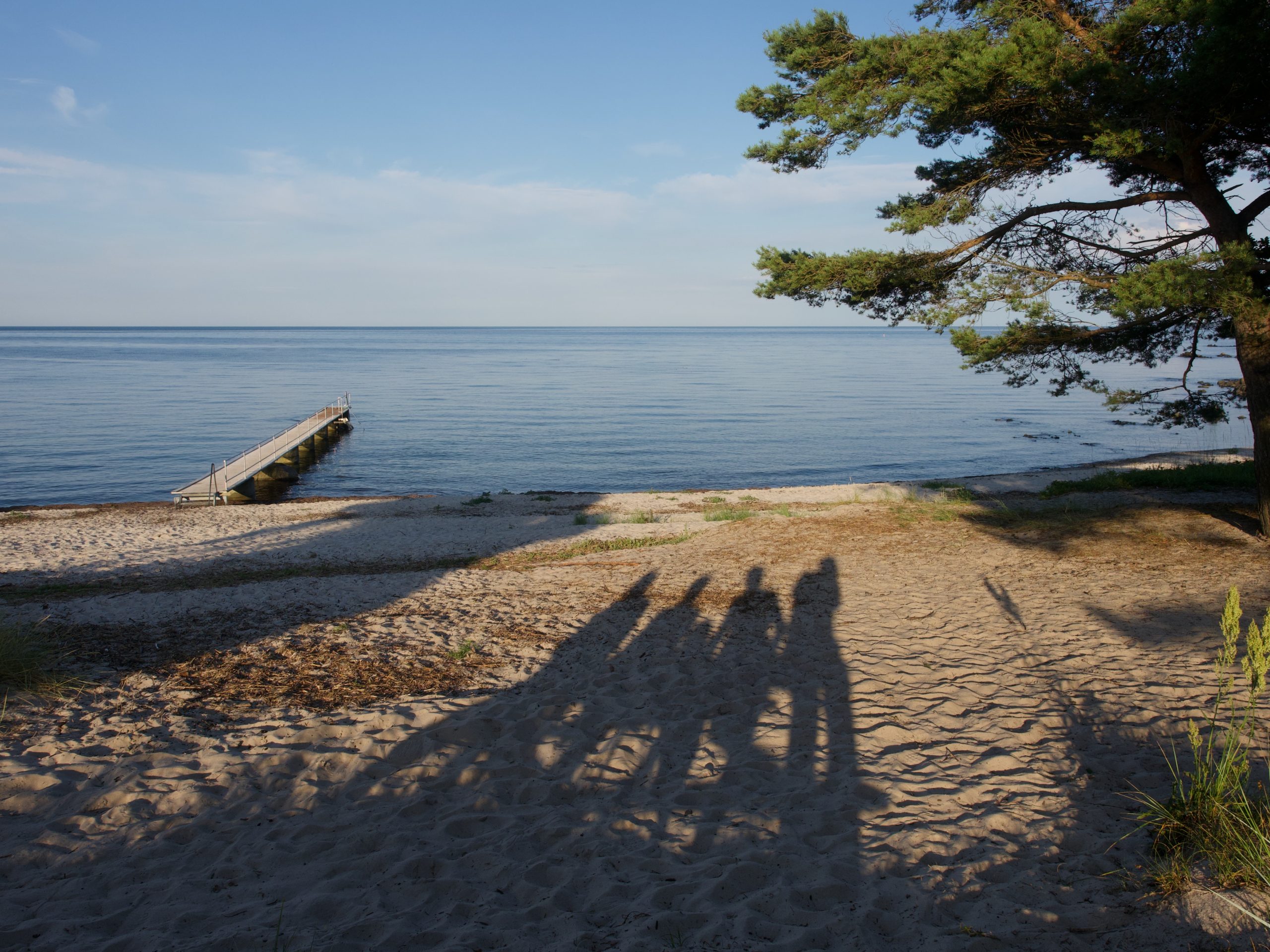
After we’d explored the castle, we walked back along the road to Sandvig (probably about a mile and a half) and had coffee, Mexican cola, and apple juice at a little shop while we waited for the bus to come. We were home a bit after 3 pm (Mark and I took a small detour to grab some groceries for dinner) and took a bit of a rest–we had walked about 10 miles. We fixed pasta and salad for dinner and had ice cream with chocolate wafers for dessert; it was delicious. And because we just couldn’t stop ourselves, we did go for a little walk in the evening, down to a beach area just down from us by a little bit, where we stuck our feet in the (rather cold) water and watched some VERY funny shore birds that looked like they were racing each other–and later were chased away by a very bossy white swan.