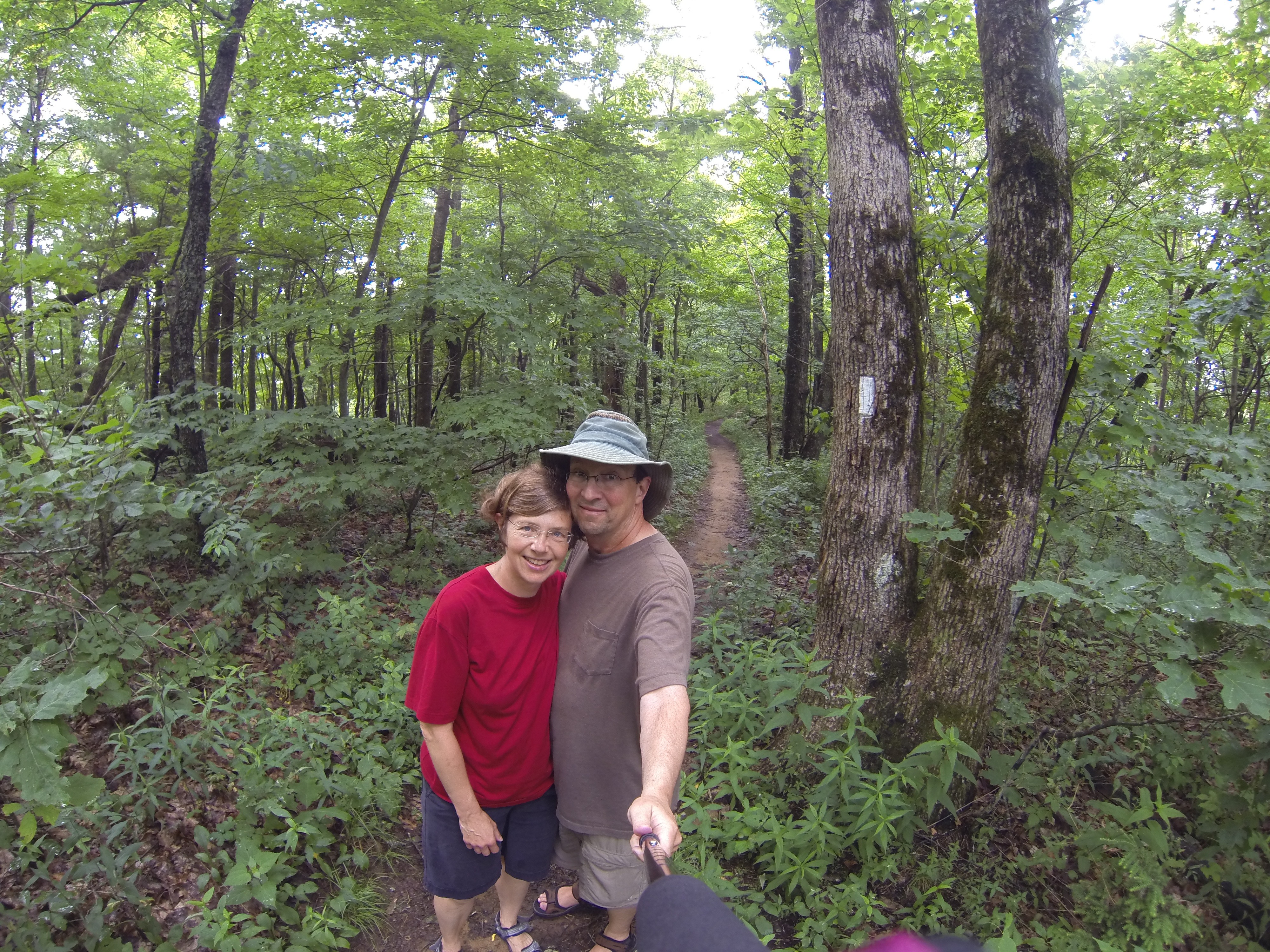
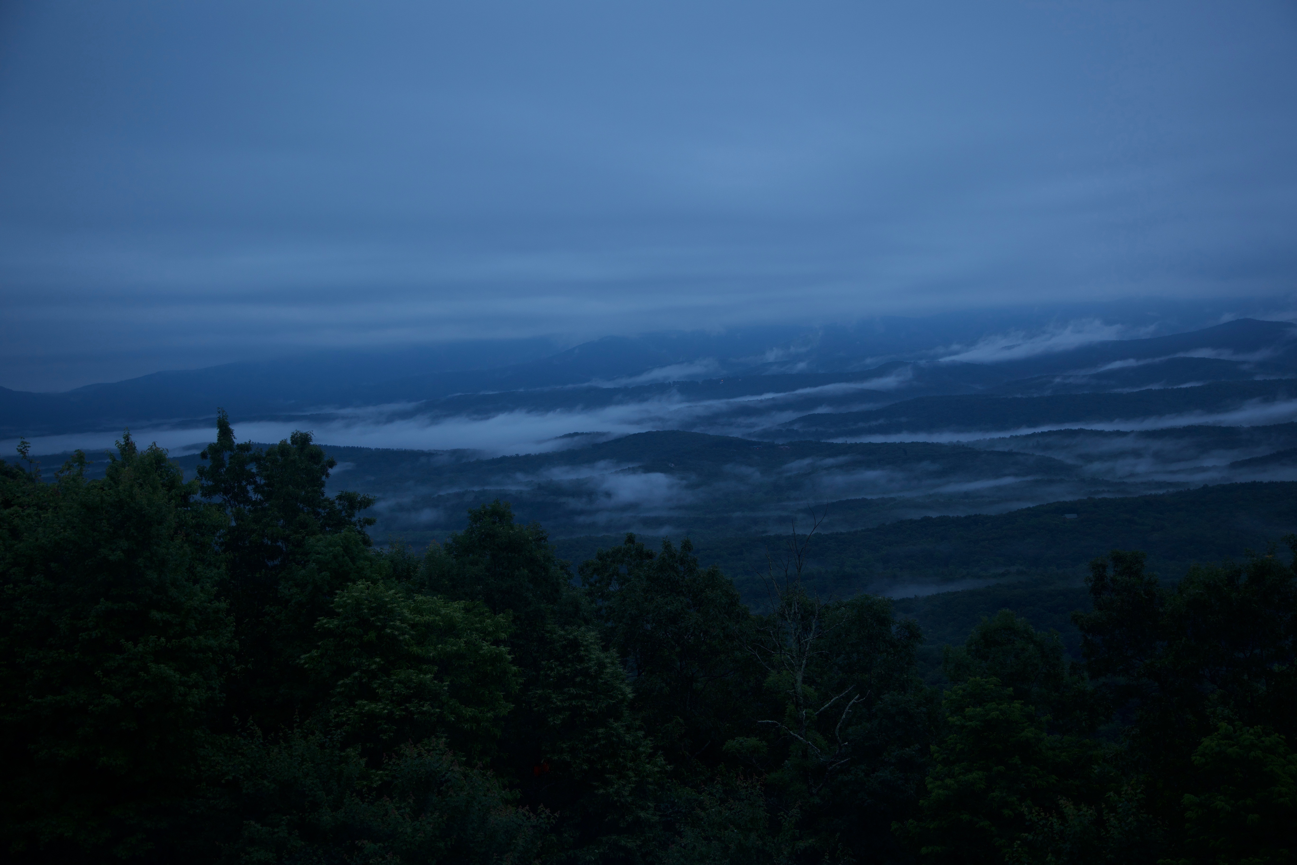
Today, we ended up doing a whole lot more driving and less hiking than expected. But the day started with some “nature TV” of the best sort. Late last night, we were already watching some fabulous lightning in the sky over the mountains. Then, we woke up very early, before sunset, and watched the layers of mist between the layers of mountains from our big window—really beautiful! Since this was the first hotel night without a breakfast included since forever ago (Fort Meyers Beach, I think), we actually just had yogurt and almonds in our room. Then we checked out and, just before it began to pour buckets of rain, got into our car and drove off. Our goal was Brasstown Bald Mountain, the highest mountaintop in Georgia, but we were ready to explore this and that on the way. Our opportunity came where the Appalachian Trail (apparently “the AT” to the ambitious few who hike it) actually crosses the road and goes through a building near a place called “Neel’s Gap.” We checked out the historic trading post/resting spot that has been created there (they sell very modern camping gear, as well as AT t-shirts, including the one we should have gotten, “I hiked the entire [width of the] Appalachian Trail.” Because we also stopped at a trail head and hiked the glorious 0.7 miles of a trail that met the AT on its way to Blood Mountain (that would have been another 2.5 miles or so). So we did set foot on the real AT, and one day we do want to hike a bit of it. But not the 2,100+ miles from Georgia to Maine!
After our little AT adventure, we drove to the plateau at the top of Brasstown Bald and walked the 0.6 rather steep miles to the top of that (a shuttle could have gotten us there too, but we have our ambitions). It was very beautiful up there, at about 4,700 feet, which is high relative to the plateau from which the North Georgia mountains rise, but because the day had started out foggy and cloudy, we only could see a little ways into the distance and didn’t get the full, spectacular effect of seeing all the surrounding mountains. And because our standard idea of mountains is based on the Rockies, I am having a bit of a hard time thinking of these mountains as “high” because they are all covered with vegetation! Given that they rise basically from sea level, they never reach up to the tree line and they don’t have craggy or snowy tops, but look “round” and hilly to me. Nonetheless, it was fun to go up there—and to top it all off, on the way out we actually saw a black bear cross the road! Of course, he was gone too fast for a good photo, but Mark managed to get at least “proof” with his cell phone.
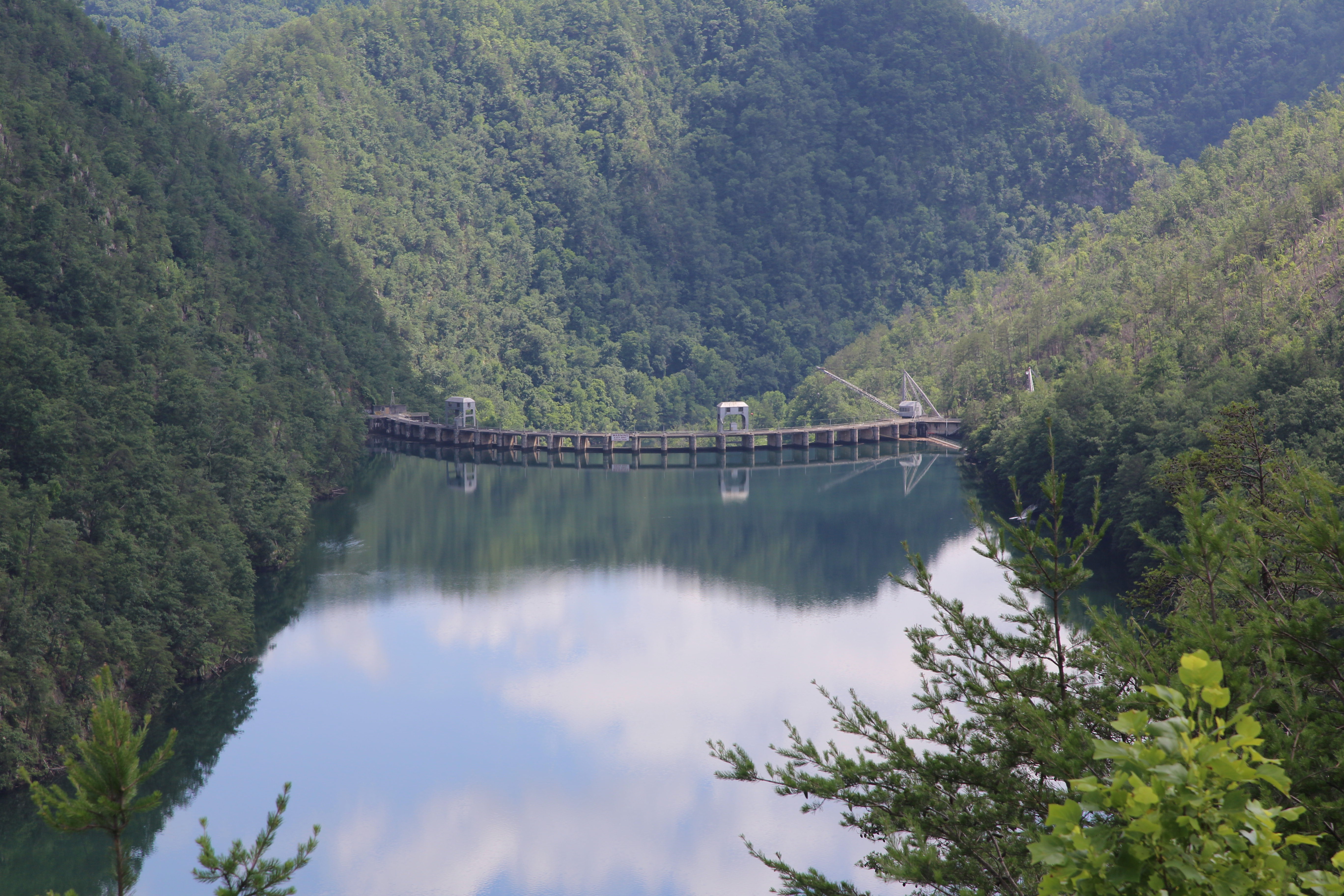
We then took off, again just as it started to rain, and drove through rather heavy downpours in search of lunch. We got to Hiawassee, a small, unassuming town by a lake / valley, and found a modest and super cheap little place with just the right kind of roadside Chinese food. Then we drove on, still mostly in the rain, determined to drive out from under it as we crossed into North Carolina and headed further west. We did manage to get back into the sun as we were driving northwest out of the mountain just south of the Great Smoky Mountain National Park (for which we just don’t have the time). What we discovered was that this particular road, the 129 through parts of North Carolina and Tennessee, is incredibly curvy—beautiful and very green, with the occasional glimpse of the mountains and, later, the Little Tennessee River, but without any good hiking stops and few pullouts of any sort. This is because a) everyone must be hiking inside the actual national park or on the Appalachian Trail, and b) this is Motorcycle Road. It’s actually nicknamed “The Tail of the Dragon” complete with gift shops and motorcycle-only campgrounds, because it is so awesome to drive on a motorcycle or in a sports car, and that’s what everyone was doing. We must have seen a hundred bikers, although there were only a handful of sports cars, on the 20-mile stretch that has most of the curves.
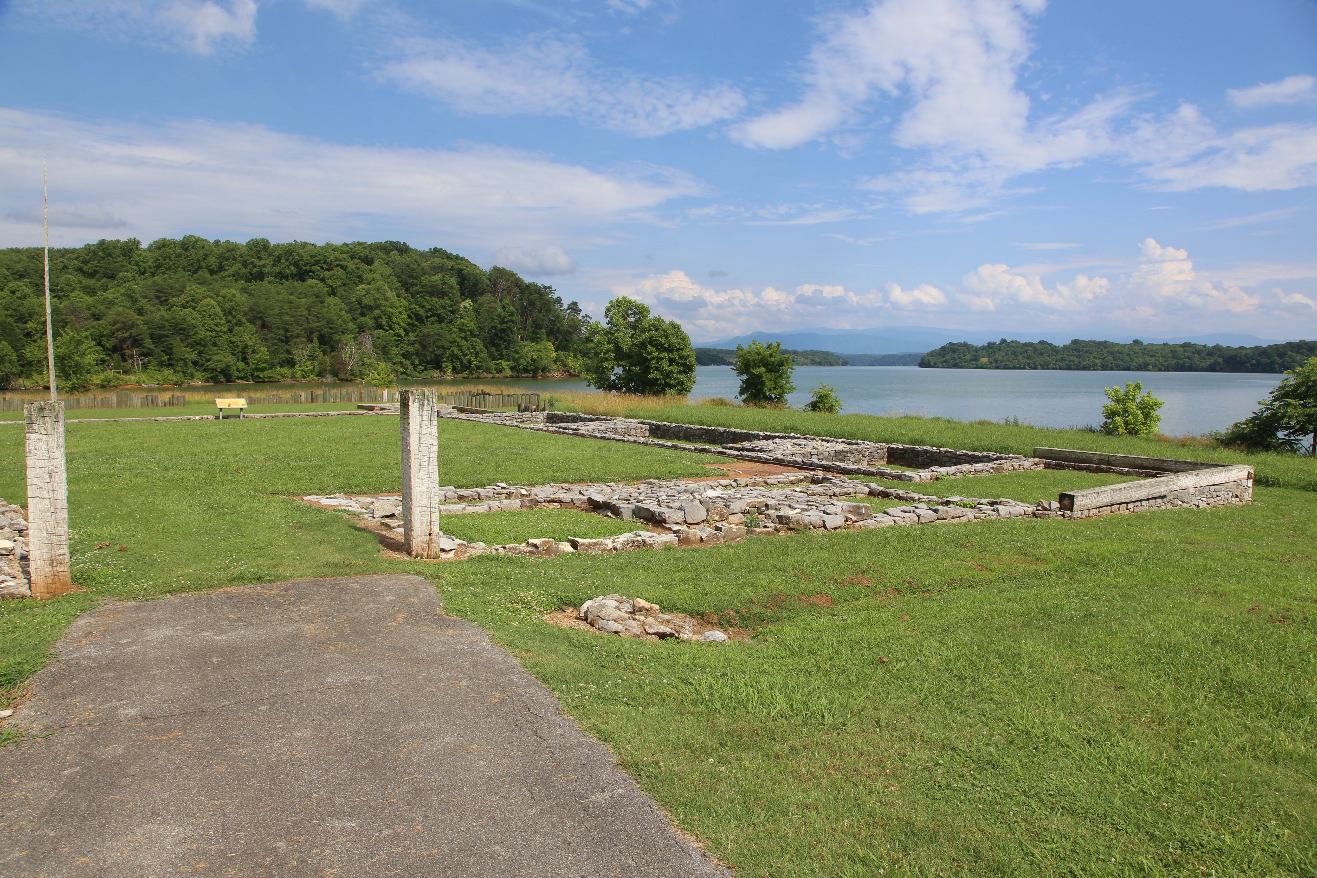
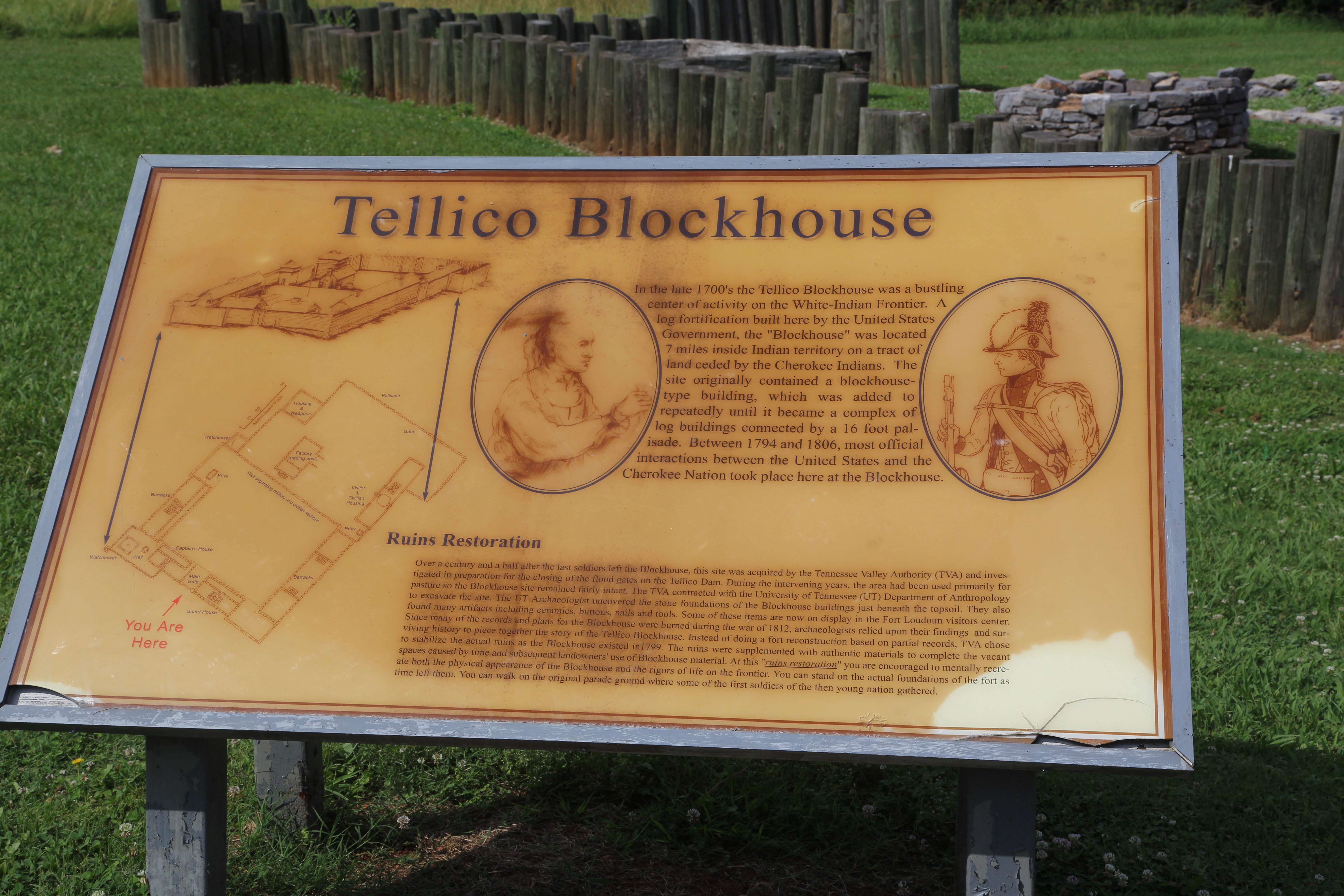
When we came out of the mountains, we made one more stop along the Little Tennessee River, at a historic marker for a late 18th-century British trading post called the Tellico Blockhouse. It was just nice to get out of the car, and I was amazed how wide the Little Tennessee is; it is dammed, but even before it ever was, it was 600 feet across at this particular spot. Our only ambition for the rest of the day was to find some simple food for dinner (which we did at one of those chain-restaurant brew pubs: we split a salad and a personal pizza and spent a glorious $15.00 including drinks and tip. We are a bit tired of overeating, but I do admit to us having a McDonald’s sundae each later on.) and to reach the I-40, which we will be driving on tomorrow for many, many hours. We stopped just a bit west of Knoxville at a very new and comfy Comfort Inn right off the freeway, and settled in for the night fairly early. I tried to use the pool, since we had one, but it was practically by the roadside and really boring after all the lake, spring and ocean swimming—I am spoiled for pools now, and I came back after about 10 minutes.